“It’s hard to believe but we’re in good shape for the time being,” said Cindy Mullaney.
The deputy director of the Flathead County Office of Emergency Services, like many others in the region, has closely monitored weather data related to the persistent rainfall over Northwest Montana and has not received any reports of flooding in the greater Kalispell area.
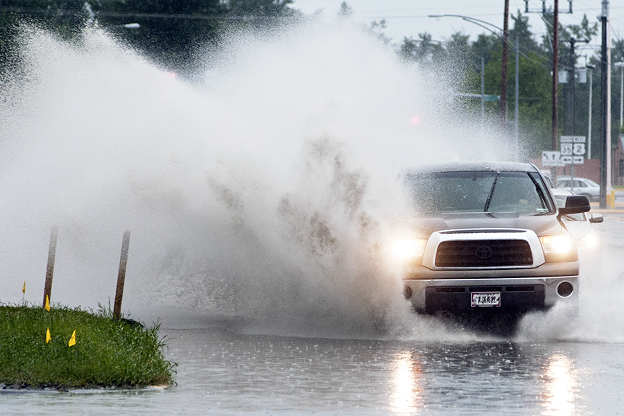
The past 36 hours have seen a significant rain event with 1 to 2.5 inches in the valleys and 2 to 3 feet of snow in Glacier National Park. Kalispell received 1.74 inches of rain yesterday, tying for the eighth most precipitation in a 24-hour period of any single day since records were first kept in 1899, according to the National Weather Service.
“Overall, this looks to be one of the heaviest precipitation events for northwest Montana in quite some time and very well could be the big event for the summer,” the weather service said in its latest advisory.
Lowland flooding and significant ponding is occurring on some area roads, but the valley’s waterways are not currently posing any serious threats, Mullaney said.
At the Canadian border, the North Fork Flathead River is running at 9.82 feet and is projected to slightly surpass flood stage at 10.57 feet. That would mean water would likely affect low-lying areas near the river, including the North Fork Road to Polebridge.
The Middle Fork Flathead River in West Glacier is running at 6.43 feet and is projected to reach 7.92 feet. The flood stage designation is 10 feet.
The Flathead River in Columbia Falls is running at 11.24 feet and projected to gain another two feet by Thursday, which would put it right at or slightly above the flood stage designation. That would mean possible groundwater flooding and impacts on croplands in Lower Valley, Mullaney said.
Evergreen could similarly see groundwater flooding as low lying areas near the river’s edge are the most susceptible to impacts, Mullaney said.
Other concerns could be raised by log jams being forced down river with high water.
The Swan River near Bigfork is running at 4.99 feet and projected to hit 5.75 feet. Flood stage is 6.5 feet.
The Stillwater River at Lawrence Park in Kalispell is running at 5.12 feet and will hit 5.94 feet. Flood stage is 7.5 feet.
Rainfall is expected to increase tonight but drop significantly Thursday, according to the National Weather Service.
Heavy Snowfall Hits Glacier Park; Sites Closed
Another 4 to 8 inches of snow is expected to fall at elevations above 6,500 feet and some sites in Glacier National Park are being closed due to debris and flooding, according to park managers.
No evacuations have been initiated at this time, but pre-evacuation planning for nearly 40 people is underway for the St. Mary area of National Park Service administrative and housing areas and for the Many Glacier Hotel area.
St. Mary Campground is closed due to standing and running water and debris from Wild Creek and other runoff water, according to the National Park Service. There were approximately 10 campers at the St. Mary Campground last night, and all left this morning on their own, prior to campground closure, spokesperson Denise Germann said.
Access to the Kintla Lake area is closed at the head of Big Prairie, seven miles north of the Polebridge entrance in the North Fork District of the park. Travel in the North Fork area of Glacier National Park is not advised at this time as there is standing water in several areas.
Red Eagle Lake Trailhead, near the 1913 Historic Ranger Station by St. Mary, is closed.
Park crews deployed sand bags in the administrative area of St. Mary on the east side of Glacier, in response to the flooding of Divide Creek.
Park personnel continue to monitor and assess the situation across the park and are making preparations in the event of any evacuations, Germann said.
All visitors are encouraged to use caution during this time of increased moisture.
Flood Concerns Rise as Heavy Rainfall, Snow Pound Northwest Montana
Following one of the rainiest days on record in Kalispell and heavy precipitation across the region, the National Weather Service is warning about flooding in the next few days, including along the main stem and north fork of the Flathead River, while parts of Glacier National Park are closed and undergoing pre-evacuation preparation.
Kalispell received 1.74 inches of rain yesterday, tying for the eighth most in a 24-hour period of any single day since records were first kept in 1899, according to the NWS. The record amount — 2.71 inches — fell June 29, 1982.
Meteorologists predict rainfall will increase this afternoon and tonight with another inch of rain possible. The weather should clear up by Thursday, but that’s when flooding could occur along the Flathead River, which is expected to hit 14 feet, or one foot above flood stage.
Nearly 5 inches of snow has fallen at Marias Pass and the higher elevations in Glacier Park received 2 to 5 inches of wet, heavy snow. More than 14 inches of snow was recorded at Sperry Chalet. The weather service issued a winter storm warning for Marias and along the northern Rocky Mountain Front.
Flooding has already occurred near East Glacier as a result of significant runoff from the St. Mary River, which is above flood stage. Divide Creek is running over the park’s Going-to-the-Sun Road and debris flow temporarily closed state Highway 49 north of East Glacier, according to the NWS.
Park spokesperson Denise Germann said evacuation preparations are taking place near the Many Glacier Hotel area and the St. Mary area, while crews stage equipment like backhoes in certain areas as precautionary measures. The park’s plow crews halted operations yesterday along the Sun Road as a safety measure, Germann said.
Up the North Fork, the road to Kintla has standing water on it, and park officials are discouraging travel.
“The North Fork of the Flathead River is definitely rising,” Germann said.
Germann said managers are monitoring and assessing the situation throughout the entire park.
Another reason for flood concerns is the heavy rainfall hitting southern Alberta, where nearly 7 inches of rainfall has landed near the border.
The heaviest precipitation has been along the Continental Divide, near the Canadian border, Glacier National Park and across the Mission Mountains. Cut Bank received 1.23 inches of rain on Tuesday, which broke a daily record set in 1948, the weather service said.
Babb recorded 4.25 inches of rain over 24 hours, while Goat Haunt inside the park received 4.94 inches.
Light snowfall was reported in Kila as temperatures have dropped.
A flood warning also has been issued over a broad swath from the mountains to east of Browning, where 1.5 inches of rain has fallen in the last 24 hours.
Lake County is also under flood watch, with small streams and creeks from the Mission Mountains flowing at the banks and potentially spilling over, causing localized flooding. Significant ponding on roadways is also possible, according to the NWS.