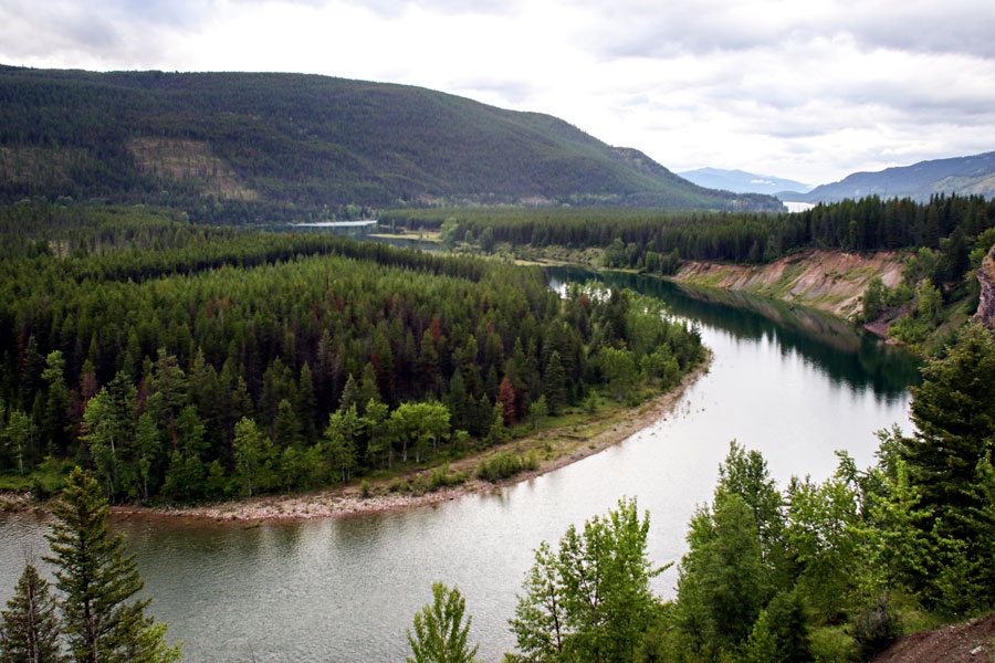
On the 50th anniversary of the Wild and Scenic Rivers Act, the Flathead National Forest, in coordination with Glacier National Park, is seeking public input as it develops a comprehensive management plan for the three forks of the Flathead River.
A series of six public meetings are scheduled over the next six months. The first meeting, on May 16, will focus on water-quality conditions, management and concerns on the Middle, South and North forks of the Flathead River. It will be held at the Heaven’s Peak Room of Cedar Creek Lodge in Columbia Falls from 6 to 8 p.m.
The meeting will include presentations on current water-quality information, as well as “facilitated discussion on how water quality should be addressed” in the comprehensive river management plan (CRMP), according to the U.S. Forest Service. A brief introductory presentation to the Wild and Scenic Rivers Act will begin at 5:45 p.m.
“The CRMP will address the current status of the river and the surrounding resources, outline goals and desired conditions, determine user capacity and create a monitoring plan for the next 15 to 20 years,” the Forest Service states.
“In order to reflect the diverse users of the river and surrounding lands, the public is encouraged to help craft the future management of this designated wild and scenic river to ensure the river and its outstanding resources are maintained and protected.”
Chris Prew, the Flathead National Forest’s recreation program manager, said the meetings, the rest of which will be scheduled soon, aren’t an official comment period but rather an opportunity to foster dialogue beneficial to both managers and the public.
The meetings, which will focus on different topics, will then inform later stages of the plan’s development through the National Environmental Policy Act (NEPA) process. A formal scoping and public comment period is expected to occur in the winter.
Representatives from the Forest Service and National Park Service will be in attendance, as will representatives from HydroSolutions Inc., a Helena engineering, water and natural resource consulting firm that was awarded the contract to coordinate the plan’s development after a competitive bid process.
The goal is to have a completed, signed comprehensive management plan by 2020. It will be a thorough update to the river system’s existing management plan, which was originally crafted in 1980 and amended in 1986.
The Forest Service and National Park Service share management responsibilities because the North Fork and lower Middle Fork form the boundaries between the Flathead National Forest and Glacier National Park.
“The more folks we can get excited in the process and engaged, the better, especially in this phase before we get into formal NEPA,” Prew said. “It’s a really good time to have a conversation with the public on issues they think need to be addressed.”
Congress passed the Wild and Scenic Rivers Act in 1968, and the Flathead’s three forks were added to the National Wild and Scenic Rivers System eight years later on Oct. 12, 1976. The Flathead and Missouri rivers are the only streams in Montana to earn the designation, which can be bestowed by either Congress or the Secretary of the Interior.
“It is hereby declared to be the policy of the United States,” the act stated, “that certain selected rivers of the Nation which, with their immediate environments, possess outstandingly remarkable scenic, recreational, geologic, fish and wildlife, historic, cultural or other similar values, shall be preserved in free-flowing condition, and that they and their immediate environments shall be protected for the benefit and enjoyment of present and future generations.”
Designated rivers are listed under three classifications: wild, scenic and recreational. Wild rivers, or sections of river classified as wild, are “free of impoundments and generally inaccessible except by trail, with watersheds or shorelines essentially primitive and waters unpolluted.”
“These represent vestiges of primitive America,” according to the National Wild and Scenic Rivers System’s guidelines.
Scenic river areas are also free of impoundments, with “largely primitive” watersheds and “largely undeveloped” shorelines, but are accessible in places by roads. Recreational river areas are “readily accessible by road or railroad” and may have development along their shorelines and may have “undergone some impoundment or diversion in the past.”
Of the 219 designated miles of the Flathead River’s three forks, 97.9 are wild, 40.7 are scenic and 80.4 are recreational, encompassing the North Fork from the Canadian border to its confluence with the Middle Fork, the South Fork from its headwaters to Hungry Horse Reservoir and the entire Middle Fork.
“Regardless of classification, each river in the National System is administered with the goal of protecting and enhancing the values that caused it to be designated,” the classification guidelines state.
For more information, call Flathead National Forest Recreation Program Manager Chris Prew at (406) 758-3538 or visit the national forest’s website.