Northwest Montana Sees Above Average Snowpack
Officials say snowpack levels are above average while unusually cold temperatures are resulting in unstable avalanche conditions during the third consecutive La Niña winter
By Maggie Dresser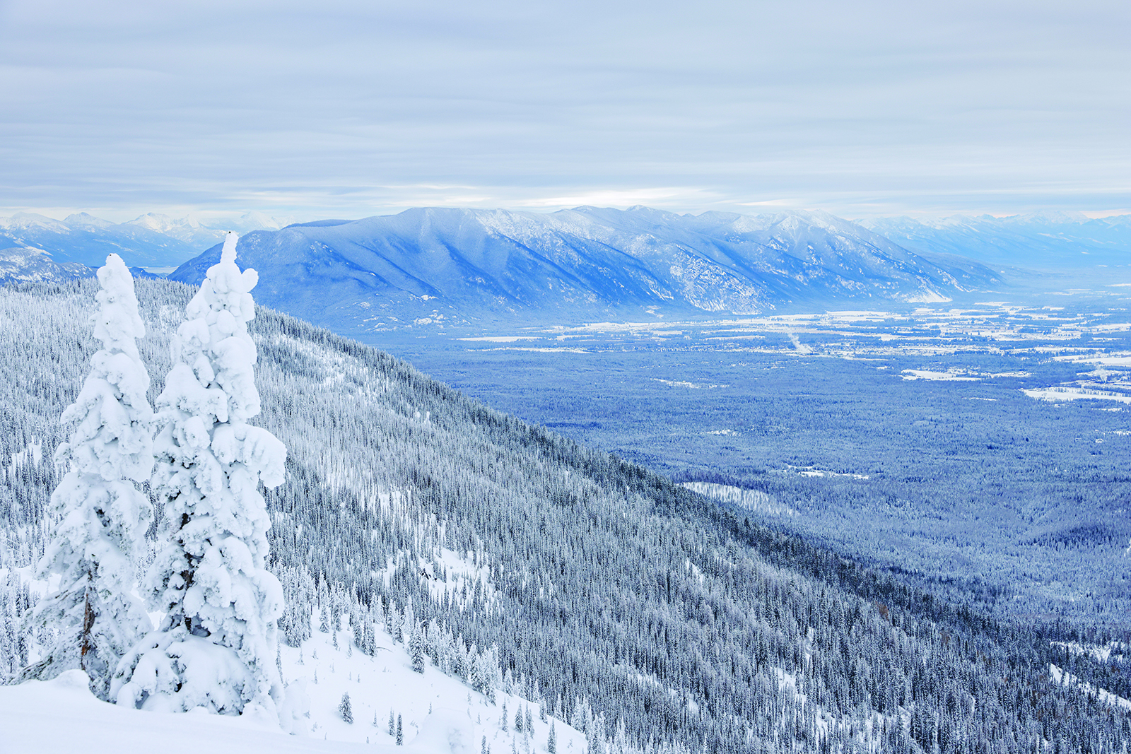
As consistently cold temperatures and snowy conditions continue in the Flathead Valley, water supply specialists and avalanche forecasters say the snowpack is above average in northwest Montana’s river basins and the winter season is off to a good start.
On Dec. 9, the snow water equivalent (SWE) – the amount of liquid in the snow – in the Flathead River Basin levels were 119% of normal based on median percentage between 1991 and 2020. The Kootenai was 102%, the Sun-Teton-Marias was 123% and St. Mary’s was slightly below average at 96%.
“The seasonal snowpack and the timing of when it started is right on time and within a week of the normal start date for northwest Montana,” said Eric Larson, a hydrologist with the United States Department of Agriculture (USDA) Natural Resource Conservation Service.
Now that Montana is in its third consecutive La Niña winter, Larson says the region is experiencing typical conditions, but it doesn’t always guarantee plentiful precipitation.
As of Dec. 9, the snow depth at 6,300 feet on Flattop Mountain in Glacier National Park was 48 inches, and Whitefish Mountain Resort reported a 49-inch base at the 6,817-foot summit.
But while the precipitation is at a slightly above average level, Larson says temperatures in recent months have been much cooler than normal. In November, the daily mean temperature across the state was 5 to 10 degrees below normal.
Last year, Larson said the precipitation started around the same time, but it wasn’t as consistent. In comparison, the beginning of October this year was dry, but there was a “meteorological switch” that brought cold temperatures and steady snow.
At the Flathead Avalanche Center, Executive Director Blase Reardon says November snow at high elevations is common, but it often melts, or rain will fall on top of it, washing the snow away.
“We haven’t had the rain events that we normally get,” Reardon said. “We are getting snow – it’s cold and dry and it’s not getting rained away … It feels like the middle of winter and the mid and low elevations are not losing snow and it feels like we have a lot of snow. But the reality is we still have a shallow snowpack.”
With a cold, dry and shallow snowpack brings instability, Reardon says, and the avalanche season is already well underway as skiers and riders continue to report avalanches in the forecast area, which includes Glacier National Park, and the Flathead, Swan and Whitefish ranges. Despite regular activity, no accidents or burials have been reported as of Dec. 9.
Cold temperatures promoted facets in the snow, or weak, sugary snow grains within the snowpack that doesn’t bond well, which resulted in an unstable layer that has already proven to be reactive. Numerous avalanches have already been reported to the avalanche center, and Reardon expects hazardous conditions to continue.
“If you look at our observation page, every observation since the first of December has included an avalanche or other signs of instability,” Reardon said. “All but two of the 47 or so observations have included signs of instability.”
While these conditions are not typical for northwest Montana, Reardon says it resembles a snowpack comparable to Colorado, a region that regularly sees a weak snowpack due to colder and drier conditions.
“That’s why I joke that everybody should welcome themselves to Colorado,” Reardon said.
The weak snowpack means that recreationists might need to develop different skillsets to manage the hazards, and Reardon says staying off slopes steeper than 35 degrees is the best way to approach the current conditions. Using inclinometers and recognizing slope angle will be the most important discipline, he said.
“These conditions are unusual for a lot of people and when we are dealing with unfamiliar conditions, it’s important to leave a wider margin for surprises,” Reardon said.
Unless the region experiences a heavy storm causing a natural avalanche cycle, which would “crush and flush” the current weak snowpack, Reardon says the instability is likely here to stay for the foreseeable future.
According to the National Weather Service’s three-month outlook, western Montana will see above average precipitation with below average temperatures.
For the latest avalanche forecast, visit www.flatheadavalanche.org.