Flathead Forest Fire Growth Prompts Recreation Closures Along Hungry Horse Reservoir, Spotted Bear Ranger District
Officials in Lake County tell Elmo residents to be 'ready' for possible pre-evacuation warnings
By Micah Drew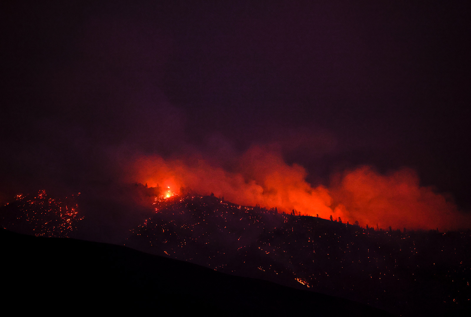
The Tin Soldier Complex burning in the Spotted Bear Ranger District of the Flathead National Forest grew 600 acres in the past day, leading forest officials to close broad sections of the front country to all recreation use. Meanwhile, the Ridge Fire north of Hungry Horse Reservoir eclipsed 600 acres and prompted additional closures in the Coram Experimental Forest.
A Type 3 Incident Management Team has assumed control of the complex, which comprises four lightning-sparked fires burning southwest of Hungry Horse Reservoir. The smaller Con Kelly fire was declared contained and controlled by crews on Wednesday, but the Sullivan, Kah Mountain and Bruce fires all saw significant growth as they continue burning in heavy timber with an abundance of dead and downed fuels.
Firefighters are working to protect several threatened structures in the area including the Wilderness Lodge, a hydro-electric facility, Spotted Bear Ranch, Diamond R Ranch and the Spotted Bear Ranger Station Compound. Residents in the Heinrude Creek community along the west shore of Hungry Horse Reservoir are under an evacuation order.
As the Ridge Fire grows, access to Hungry Horse Reservoir’s northern reaches remain open to the public on both the east and west sides, but land and roads within the Coram Experimental Forest have been closed to protect firefighter and public safety, fire managers announced Thursday afternoon. The western and northern boundary of the closure area starts at the junction of National Forest System (NFS) Road 497 (Emery Hill) and NFS Road 38 (East Side South Fork Road) and tracks north along the western and northern Coram Experimental Forest boundaries to Desert Mountain. The northern boundary continues from Desert Mountain due east to the Great Bear Wilderness boundary. The eastern boundary then runs southeast along the Great Bear Wilderness boundary to Tiger Creek and south to NFS Road 38. The southern boundary is formed by FSR 38 between Tiger Creek and NFS Road 497. The closure area does not include NFS Road 38 north of mile marker 37.5 (see attached maps of the closure area).
Forest official have closed all roads and trails in the front country of the Spotted Bear Ranger District, as well as all trails and roads within the boundaries of the Coram Experimental Forest public access to the NFS Road 895 (West Side South Fork Road) at mile marker 42 and the NFS Road 38 (East Side South Fork Road) at mile marker 37.5.
Closed Campgrounds and Trailheads include:
- Peters Creek Campground
- Crossover Campground
- Lower Twin Creek Trailhead
- Upper Twin Creek Trailhead
- South Fork River Access
- Spotted Bear Campground
- Spotted Bear Ranger Station
- Chipmunk Trailhead
- Meadow Creek Trailhead
- Cedar Flats River Access
- Spotted Bear Mountain Fire Lookout
- South Creek Trailhead
- Trail Creek Trailhead
- Middle Big Bill Trailhead
- Beaver Creek Trailhead
- Beaver Creek Campground
- Silvertip Trailhead
- Silvertip Rental Cabin
Stage 2 fire restrictions take effect across all public land in Flathead, Lincoln and Sanders County beginning Aug. 5, as well as within Whitefish city limits.
Across the Flathead Indian Reservation firefighters continue to battle the Niarada Fire west of Elmo, which has continued to grow and spread to the east. On Thursday, the Lake County Sheriff placed the Walking Horse Lane area under a Pre-Evacuation Warning, and moved the town of Elmo to “Ready” status, indicating residents should prepare for rapidly changing fire conditions that could prompt pre-evacuation warnings in the future. County officials said residents should make a plan in case of an evacuation, which should include gathering important documents, packing essentials and preparing a communication plan for friends and family.
A small fire on Ravalli Hill near the Bison Range was reported early this morning, but crews were able to swiftly put it out using ground crews and aerial support, according to CT Camel with the Confederated Salish and Kootenai Tribes (CSKT) Division of Fire.
There will be a community meeting regarding the Big Knife, Niarada, and Mill Pocket fires at 6 p.m. tonight, Thursday, August 3, at the Arlee Community Center, 34086 Pow Wow Road in Arlee. The meeting will be broadcast live on the CSKT Division of Fire Facebook page. A second community meeting will be held at 6 p.m. on Friday, August 4, at the Elmo Community Center, 47088 Cemetery Road in Elmo.
Major Wildfire Incidents
Please note that the following reflects the latest information received at the time of publication.
Mill Pocket / Niarada Fires
Location: 15 / 12 miles west of Elmo
Size: 1,929 acres / 13,686 acres
Containment: 0% / 0%
Personnel: 66 firefighters
Current Cost of Operations: $3.1 million
Evacuation Warnings/Orders and Road Closures: The Lake County Sheriff has placed the Walking Horse Lane area under a Pre-Evacuation Warning, and the town of Elmo is in Ready status. Residents along Browns Meadow Road from Highway 28 to the top of the pass, including Kofford Ridge Road, are under an Evacuation Order. Hubbart Dam Road/NF-544 from the intersection of Crossover Road south to Highway 28 are under Pre-Evacuation Warnings. Montana Highway 28 has reopened from its junction with U.S. 93 at Elmo with speed restrictions. Additional road closures can be seen on the map below.
Operational Updates: A Complex Incident Management Team (CIMT) is jointly managing the Niarada, Mill Pocket and Big Knife fires. Niarada Fire remained active Wednesday, spreading both to the northeast and southeast towards Elmo. Crews, heavy equipment, engines, helicopters, and fixed-wing aircraft continue to work the fire, building firelines from safe anchor points and protecting structures in the area
Big Knife
Location: 5 miles east of Arlee
Size: 2,710 acres
Containment: 0%
Personnel: 122 firefighters
Current Cost of Operations: $3.75 million
Evacuation Warnings/Orders and Road Closures: No mandatory evacuations at this time. The Lake County Sheriff has several areas near the base of the mountains west of the Big Knife Fire under Pre-Evacuation orders. See the map for those locations in yellow (Jocko, Canal, Francis).The Canal Road, from Mountain Home Road to the Jocko Canyon Road, is closed. In the Tribal Primitive Area, Belmore Slough and Burnt Cabin Roads are closed.
Operational Updates: The Big Knife Fire burned actively Wednesday, with a spot fire south of Big Knife Creek burning eastward into the South Fork Jocko Tribal Primitive Areas and a portion of the fire also well-established on the north side of the Big Knife drainage. Arlee Volunteer Fire Department has been notifying residents in Jocko Canyon of the fire’s movements.
Tin Soldier Complex
Location: 17 miles east of Swan Lake
Size: 2,061 acres
Containment: 0%
Personnel: 50
Evacuation Warnings/Orders and Road Closures: Evacuation Orders are in place for residents of the Heinrude community and surrounding area. West Side South Fork Road #895 is closed to public travel at mile 42 and the East Side South Fork Road #38 is closed at mile 37.5. The Spotted Bear district front country is closed to recreational use, excluding the wilderness area.
Operational Updates: A Type 3 Incident Management Team is managing the complex, which comprises the Bruce, Sullivan, Kah Mountain and Con Kelly fires. The three main blazes are being managed with point source protection to protect commercial, residential and government structures in the area including the Spotted Bear Ranger Station compound. The Con Kelly fire is contained.
Colt Fire
Location: 12 miles northwest of Seeley Lake
Size: 6,860 acres
Containment: 19%
Personnel: 621 firefighters, 5 helicopters
Current Cost of Operations: $13.7 million
Evacuation Warnings/Orders: The Evacuation Order for mile marker 31 (Beaver Creek Road at the intersection of Highway 83) south towards Seeley Lake to mile marker 27, and including residences in Rovero Flats, has been lifted and these areas are now under an Evacuation Warning. Residents on Beaver Creek Road (near the summit) are under an Evacuation Warning. Residences beginning at mile marker 27 (south end of Rovero Flats) to mile marker 25.5 (the intersection of the West Fork of the Clearwater Road and Highway 83) are under an Evacuation Warning. Residences on the north and south ends of Lake Inez are under an Evacuation Warning.
Operational Updates: Eight different agencies are providing support for firefighting operations. The fire remains active in the southwest and southeast corners. Containment increased to 19%, with containment lines holding on the east perimeter.
Communication Butte Fire
Location: 2 miles north of Dixon
Size: 1,423 acres
Containment: 35%
Personnel: 14 firefighters
Current Cost of Operations: $350,000
Evacuation Warnings/Orders and Road Closures: The Bison Range at Moiese has reopened. All evacuation warnings in Moiese have been lifted.
Operational Updates: Crews have built a containment line around the fire’s perimeter. Mop-up continues along the entire fire line, starting on the east and west side of the river,
Middle Ridge Fire
Location: 15 miles west of Ronan
Size: 12,698 acres
Containment: 25%
Personnel: 59 firefighters,
Current Cost of Operations: $1.2 million
Evacuation Warnings/Orders: None
Operational Updates: A Type 3 Incident Command Team is managing the fire with full suppression tactics. The fire has not increased in size in the last 24 hours Crews will continue mop-up today, putting out any hot-spots along the entire fire line.
Ridge Fire
Location: 6 miles southeast of Hungry Horse
Size: 633 acres
Containment: 0%
Personnel: 26
Evacuation Warnings/Orders and Road Closures: None
Operational Updates: A Type 3 Incident Management Team assumed command of the fire this morning and is working towards full suppression. Crews are taking steps to protect communications towers near Desert Mountain and keep the fire away from Martin City and private land near FS Road 38.
East Fork Fire
Location: 12 miles south of Trego
Size: 453 acres
Containment: 0%
Personnel: 106
Evacuation Warnings/Orders and Road Closures: None
Operational Updates: