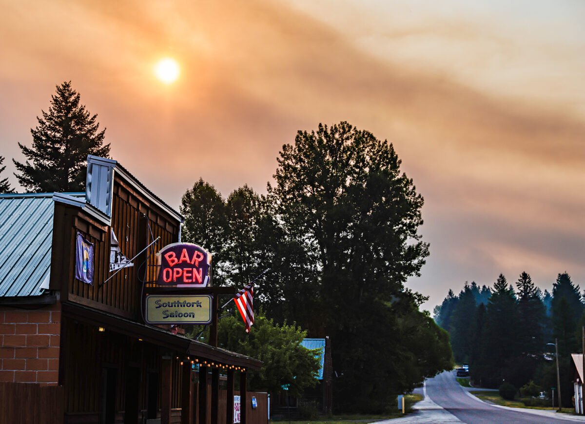
Forest Service Evacuates Campgrounds as Ridge Fire Reaches Hungry Horse Reservoir
The Ridge Fire has nearly tripled in size over the last 24 hours, burning to Hungry Horse Reservoir and forcing recreation evacuations in the area
By Micah Drew
Flathead National Forest officials on Thursday night closed the entirety of the East Side Reservoir Road (NFS Road 38) along Hungry Horse Reservoir due to the rapid spread of the Ridge Fire, which included mandatory evacuations of all campers at Emery Bay Campground and dispersed campsites in the area.
The lightning-sparked Ridge fire has nearly tripled in size over the last 24 hours and is now estimated at 1,576 acres. Ninety firefighting personnel, including two dozers, two water tenders and three hand crews are actively working on the incident, prioritizing the west side of the fire to prevent further spread towards the communities of Coram and Martin City. There are currently no evacuation warnings or orders for residents of either community.
A majority of front-country public land in the Spotted Bear Ranger District of the Flathead National Forest is closed to all recreational access due to both the Ridge Fire to the north and the Tin Soldier Complex burning southwest of Hungry Horse Reservoir.
The Tin Soldier Complex, comprising three separate fires, is threatening more than 100 structures including residential property, commercial guest ranches and the Spotted Bear Ranger Station compound.
Recreational closures do not currently apply to the Spotted Bear or Bob Marshall Wilderness areas, but will impact hikers on extended backpacking trips or floaters along the South Fork Flathead River who may already be in the backcountry. Kira Powell, the communications officer with the Flathead National Forest, said forest officials are working to put signage along all trails and trailheads to alert recreational users of the closure.
“On the ground, physically, it’s very clear where the closures begin, and we’re relying on people to assess the situation and make the right and safe choice,” Powell said. “While there are enforcement opportunities, there are only so many first responders and we would like them to be proactively working to administer the closures by helping people leave unsafe areas rather than chase people down to enforce these regulations.”
The two largest fires in the region, the Niarada Fire west of Elmo and the Big Knife Fire east of Arlee, saw continued growth overnight. According to morning reports from the interagency Northern Rockies Command Center, a lack of available resources in the system due to the high volume of fires in the region may begin to impact firefighting efforts. “The consequences of not getting these resources may result in not being able to meet objectives or protect values at risk,” the reports stated.
There will be a community meting tonight, Aug. 4, at 6 p.m. at the Elmo Community Center to inform residents of fire operations. A video recording of this meeting will be posted to Facebook after the meeting ends.
Firefighters with the Confederated Salish and Kootenai Tribes (CSKT) Division of Fire continue to work on several incidents on the Flathead Indian Reservation. The Communication Butte fire is fully contained, and crews are continuing mop-up operations on the Middle Ridge Fire. The Bison Range, which is managed by the CSKT, will begin closing Red Sleep Drive every day at 1 p.m. in an effort to limit any potential fire danger in the area.
Major Wildfire Incidents
Please note that the following reflects the latest information received at the time of publication. To see the latest updates for all major wildfires visit inciweb.nwcg.gov.
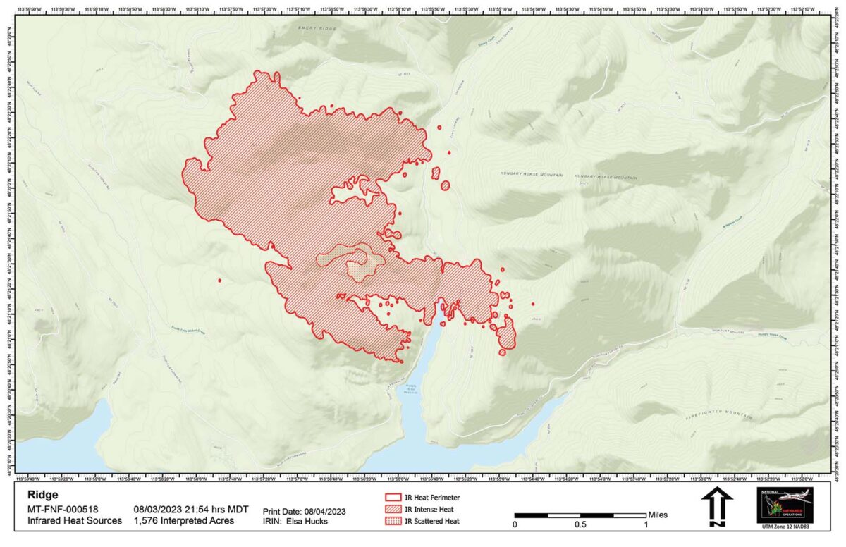
Ridge Fire
Location: 6 miles southeast of Hungry Horse
Size: 1,576 acres
Containment: 0%
Personnel: 90
Evacuation Warnings/Orders and Road Closures: NFS Road 38, East Side Road, is closed at the intersection with Desert Mountain Road. Forest Service land north and east of NFS Road 38 is closed to recreation to the wilderness boundary. See linked map for exact closures.
Operational Updates: A Type 3 Incident Management Team assumed command of the fire this morning and is working towards full suppression. Crews are taking steps to protect communications towers near Desert Mountain and keep the fire away from Martin City, Coram and private land near NFS Road 38.
Tin Soldier Complex
Location: 17 miles east of Swan Lake
Size: 2,3681 acres
Containment: 0%
Personnel: 47
Evacuation Warnings/Orders and Road Closures: Evacuation Orders are in place for residents of the Heinrude community and all recreational users in the Spotted Bear Ranger District, including all guest ranches and outfitters. West Side South Fork Road 895 is closed to public travel at mile 42 and the East Side South Fork Road 38 is fully closed to public travel. The Spotted Bear district front country is closed to recreational use, excluding the wilderness area.
Operational Updates: A Type 3 Incident Management Team is managing the complex, which comprises the Bruce, Sullivan and Kah Mountain fires. The Con Kelly fire is officially out. The three main blazes are being managed with point source protection to protect commercial, residential and government structures in the area including the Spotted Bear Ranger Station compound. Yesterday, a fuel break was established around the Wilderness Lodge and the nearby hydro-electric facility. Firefighters are installing sprinklers and hose lines near all threatened structures.

Mill Pocket / Niarada Fire
Location: 15 / 12 miles west of Elmo
Size: 2,125 acres / 14,816 acres
Containment: 0% / 0%
Personnel: 111 firefighters
Current Cost of Operations: $3.8 million
Evacuation Warnings/Orders and Road Closures: The Lake County Sheriff has placed the Walking Horse Lane area under a Pre-Evacuation Warning, and the town of Elmo is in Ready Status. Residents along Browns Meadow Road from Highway 28 to the top of the pass, including Kofford Ridge Road, are under an Evacuation Order. Hubbart Dam Road/NF-544 from the intersection of Crossover Road south to Highway 28 are under Pre-Evacuation Warnings. Montana Highway 28 has reopened from its junction with U.S. 93 at Elmo with speed restrictions. Additional road closures can be seen on the map below.
Operational Updates: A Complex Incident Management Team (CIMT) is jointly managing the Niarada, Mill Pocket and Big Knife fires. Niarada Fire remained active Thursday spreading to the east and southeast towards Elmo. Firefighters will begin structure protection in the area.

Big Knife
Location: 5 miles east of Arlee
Size: 4,412 acres
Containment: 0%
Personnel: 122 firefighters
Current Cost of Operations: $3.75 million
Evacuation Warnings/Orders and Road Closures: No mandatory evacuations at this time. The Lake County Sheriff has several areas near the base of the mountains west of the Big Knife Fire under Pre-Evacuation orders. See the map for those locations in yellow (Jocko, Canal, Francis).The Canal Road, from Mountain Home Road to the Jocko Canyon Road, is closed. In the Tribal Primitive Area, Belmore Slough and Burnt Cabin Roads are closed.
Operational Updates: The Big Knife Fire burned actively Thursday, including a run nearly a mile to the east into the Gold Creek drainage and north of Big Knife Creek. Arlee Volunteer Fire Department has been notifying residents in Jocko Canyon of the fire’s movements.

Colt Fire
Location: 12 miles northwest of Seeley Lake
Size: 7,179 acres
Containment: 23%
Personnel: 599 firefighters, 5 helicopters
Current Cost of Operations: $13.7 million
Evacuation Warnings/Orders: The Evacuation Order for mile marker 31 (Beaver Creek Road at the intersection of Highway 83) south towards Seeley Lake to mile marker 27, and including residences in Rovero Flats, has been lifted and these areas are now under an Evacuation Warning. Residents on Beaver Creek Road (near the summit) are under an Evacuation Warning. Residences beginning at mile marker 27 (south end of Rovero Flats) to mile marker 25.5 (the intersection of the West Fork of the Clearwater Road and Highway 83) are under an Evacuation Warning. Residences on the north and south ends of Lake Inez are under an Evacuation Warning.
Operational Updates: Eight different agencies are providing support for firefighting operations. The fire remains active in difficult to access terrain, requiring crews to work carefully and deliberately to ensure their safety. Crews will continue to construct hand line along the south and west sides of the fire when possible, and continue mop up work along the north and east edges.
East Fork Fire
Location: 12 miles south of Trego
Size: 453 acres
Containment: 0%
Personnel: 98 firefighters
Evacuation Warnings/Orders and Road Closures: None
Operational Updates:
Middle Ridge Fire
Location: 15 miles west of Ronan
Size: 13,000 acres
Containment: 25%
Personnel: 51 firefighters
Current Cost of Operations: $2.3 million
Evacuation Warnings/Orders: None
Operational Updates: A Type 3 Incident Command Team is managing the fire with full suppression tactics. Crews will continue mop-up today, putting out any hot-spots along the entire fire line. Mop-up operations include walking the entire fire line looking for hotspots until a 30-foot deep perimeter is considered suppressed and cold.
Communication Butte Fire
Location: 2 miles north of Dixon
Size: 1,423 acres
Containment: 100%
Personnel: 14 firefighters
Current Cost of Operations: $350,000
Evacuation Warnings/Orders and Road Closures: The Bison Range at Moiese has reopened. All evacuation warnings in Moiese have been lifted.
Operational Updates: This fire has been fully contained, and crews will continue to monitor this area.