‘Bleak Start’ for Early Season Montana Snowpack
Flathead basin snowpack currently stands at 53% of median; winter weather is forecast to converge on the region this weekend
By Micah Drew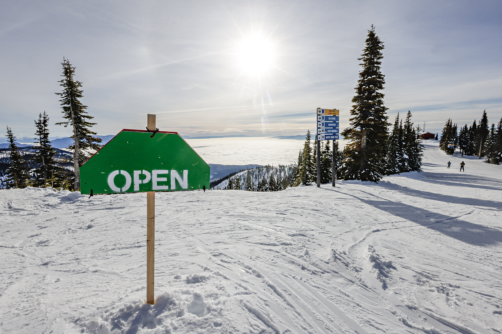
From the start of the 2024 water year, which began in October, the precipitation prognosis has not instilled much confidence in resource specialists across Montana. While a mid-October snowstorm brought some early snow to parts of the state, river basins in the northwest, including the Kootenai and Flathead, received less than half of their normal October precipitation, kicking off an unfortunate early-winter trend.
“Warm temperatures and lack of precipitation over the last couple months have resulted in a bleak start to the seasonal snowpack in Montana and northern Wyoming river basins,” said Eric Larson, a water supply specialist for the U.S. Department of Agriculture Natural Resources Conservation Service (NRCS).
The NRCS released its first water supply outlook report of the 2023-2024 winter on Jan. 4. In an accompanying press release, the NRCS noted that while a few early-season storms dropped some snow in Montana’s high country, especially in the northwest corner of the state, the state is seeing record low snowpack for the start of a new year, which could have lasting impacts for the rest of 2024.

“While it’s too early to tell what spring runoff will bring, the implications of a low snowpack extend well beyond water supply,” the report states. “Outdoor recreation during the winter is a major economic driver in Montana, and the lack of snow is certainly having an impact.”
Most ski resorts in Montana are currently operating in a limited capacity. Between Christmas and New Year’s, one of the busiest weeks for ski hills, Whitefish Mountain Resort was offering discounted lift tickets to reflect the lack of terrain open to guests. In the Missoula area, Montana Snowbowl has opened just 7% of its terrain, while visitors to Big Sky Resort, the state’s largest ski area, can only access 35% of its terrain.
According to the NRCS report, snowpack in the Flathead watershed is at a record low for this time of year, with monitoring sites registering just 53% of its median.
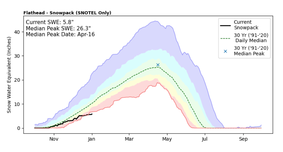
In the Flathead watershed, December precipitation was 76% of the 30-year median, higher than much of the state, but not enough to add to the snowpack. In addition to limited precipitation, above-average temperatures since October have contributed to the limited coverage. The NRCS reports that December had a mean monthly temperature more than 10 degrees warmer than normal across northern Montana. From Dec. 19-22, the SNOTEL station on top of Stahl Peak in the Whitefish Range did not record a temperature below freezing.
Snowpack in nearby Glacier National Park, traditionally one of the state’s most reliably snowy regions, is 62% of normal. Of the 175 SNOTEL sites and snow courses measured across the state, 110 are reporting either the lowest or second-lowest snowpack on record for Jan. 1, including Marias Pass, which recorded just 1.3 inches of snow water equivalent, the lowest in 89 years.
Snow-water equivalent, rather than snow depth, is the measurement used to gauge the amount of liquid water contained within snowpack, meaning the amount of water that will be released when the snowpack melts in the spring, which can play a key role in agriculture, hydropower production, water storage, aquatic ecosystem health, and recreation such as boating and fishing. Last year, snow-water equivalent in the Flathead drainage was around 80% of median, leading to drastic consequences for agriculture, business and recreation around Flathead Lake, which was more than 2 feet below full-pool elevation by summer’s end.
“It would take a major change in what the last couple months brought for weather, but it’s still early and current deficits could be recovered in a couple large storms,” according to Larson. “The further winter progresses with below normal precipitation, the more challenging it will become to make up from a lack of snow.”
The normal season for snowpack accumulation in western Montana continues through April, meaning there is time for a recovery, according to the report, which notes that a low Jan. 1 snowpack was observed in 2017 followed by record-high precipitation in February. However, “to rely on record high precipitation isn’t ideal. Winter weather needs to arrive soon.”
According to forecasts from the National Weather Service, colder and snowier weather is forecast to arrive in northwest Montana through next week. A winter weather advisory went into effect on Thursday with temperatures predicted to drop into the mid-teens early next week. Snow is forecast for the Flathead Valley for the next four days.
Explore more data with the NRCS interactive map.