Forecasts Showing Dangerous Weather Prompt Blizzard Warning for Flathead Valley
Poor visibility, impassable roadways, downed tree branches caused by gusty winds and dangerously low wind chills are all possible impacts from a winter storm hitting the area
By Mike Kordenbrock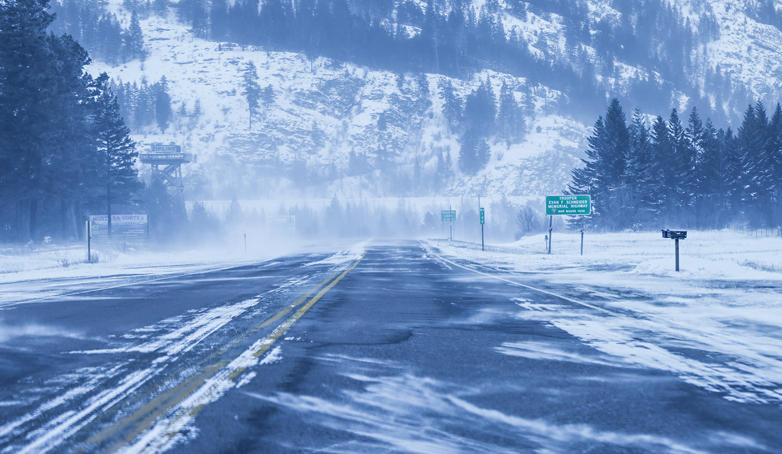
Update 7:05 p.m. 1/17/24
As of about 7 p.m., snow is continuing to fall and winds have begun to pick up in the Flathead Valley, with the National Weather Service reporting northeast winds recorded at Glacier Park International Airport blowing 23 miles per hour and gusting close to 35 mph. Conditions are expected to worsen across the next few hours, with travel becoming dangerous and potentially life threatening, per the weather service.
Original story
Forecasts showing a likelihood of dangerous weather, including whiteout conditions created by heavy, blowing snow, prompted the issuance of a blizzard warning Wednesday for the Flathead Valley, the Flathead Lake area, the Mission Valley and Polson.
The National Weather Service (NWS) put out the warning at about 9:44 a.m. Wednesday, and it is effective for the hours of 5 p.m. Wednesday until 5 a.m. Thursday. The blizzard warning comes after the weather service already issued a winter storm warning for the area showing accumulations of between 8 and 14 inches of snow, and winds gusting as high as 45 miles per hour. That winter storm warning is set to expire at 11 a.m. Thursday.
“This event is kind of two phases. Right now we’re getting all the kind of light, fluffy snow, and it’s just building and building up. We’re priming the gun for a lot of blowing and drifting snow later,” said Alex Lukinbeal, a weather service meteorologist, speaking at around 11:20 a.m. Wednesday.
Once winds kick up around 5 p.m., Lukinbeal said the change in conditions is going to be “fairly abrupt,” and that gusts could reach up to 45 miles per hour.
“Given all of that, we have pretty high concern that there’s going to be a lot of whiteout conditions and drifting snow that’s probably going to close roadways, mainly on the north and west sides of the Flathead Valley,” Lukinbeal said.
For the duration of the warning, the weather service advises people to take precautionary actions including restricting travel to emergencies only, and if travel is a must, to bring an emergency kit, including an extra flashlight, food and water.
“Falling and blowing snow with strong winds are likely. This will lead to whiteout conditions, making travel extremely dangerous. Do not travel. If you must travel, have a winter survival kit with you,” the warning says, adding that stranded individuals should stay in their vehicle.
Poor visibility, potentially impassable roadways, downed tree branches caused by gusty winds, and wind chills falling as low as 35 below zero are all possible impacts of weather conditions in affected areas of northwest Montana, where many residents already woke up Wednesday morning to a thick layer of fresh snow and more still falling.
Impassable roadways caused by blowing and drifting snow are of particular concern in the Flathead Valley, per the NWS warning. Shortly after 12:30 p.m. Wednesday, Flathead County announced it would be closing Hodgson Road from Trumble Creek to near Whitefish Stage Road, and that the gates would be lowered sometime between 2 p.m. and 3 p.m. Kim Grieser, Flathead County’s public information officer, said that the county roads department was hopeful it could begin plowing late Thursday or Friday morning to clear the area, depending on weather conditions.
The wind that’s expected to contribute to blizzard condition Wednesday is the result of a mass of arctic air that was sitting above Alberta as midday approached. That wind was expected to push down to the south and west Wednesday evening and overnight, causing temperatures to drop to somewhere between zero and minus 5. Wind chills are expected to fall low enough that frost bite could set in on exposed skin in about 10 minutes.

The Montana Department of Transportation’s interactive road conditions map showed by mid-Wednesday morning that Highway 93 between Kalispell and Whitefish was snow covered, Highway 40 between Whitefish and Columbia Falls was snow covered and Highway 2 between Evergreen and Columbia Falls was coated in a combination of snow and ice. The same map also showed Highway 93 going south from Kalispell to Elmo covered in a mixture of snow and ice, and then snow covered from Elmo down to Polson. On the east side of Flathead Lake, MDT reported Montana Highway 35 to be snow covered.
The weather is also expected to bring an increased risk of backcountry avalanche conditions. The Flathead Avalanche Center’s backcountry avalanche forecast published Wednesday morning showed considerable avalanche risk on the Whitefish Range at upper and middle elevations, and a moderate risk at lower elevations below 5,000 feet. For the Flathead Range and in Glacier National Park, the avalanche center forecasts considerable avalanche risk at upper and mid-elevations, and a moderate risk at low elevations below 5,000 feet. The same forecast showed considerable avalanche risk on the Swan Range at upper and middle elevations, and moderate risk at lower elevations below 5,000 feet.
This story will be updated.