Flathead Avalanche Center Issues Backcountry Warning
Wet snow and warm temperatures have prompted forecasters to elevate the avalanche danger to 'high' as solar radiation enters the region; the warning expires Tuesday at 7 a.m.
By Maggie Dresser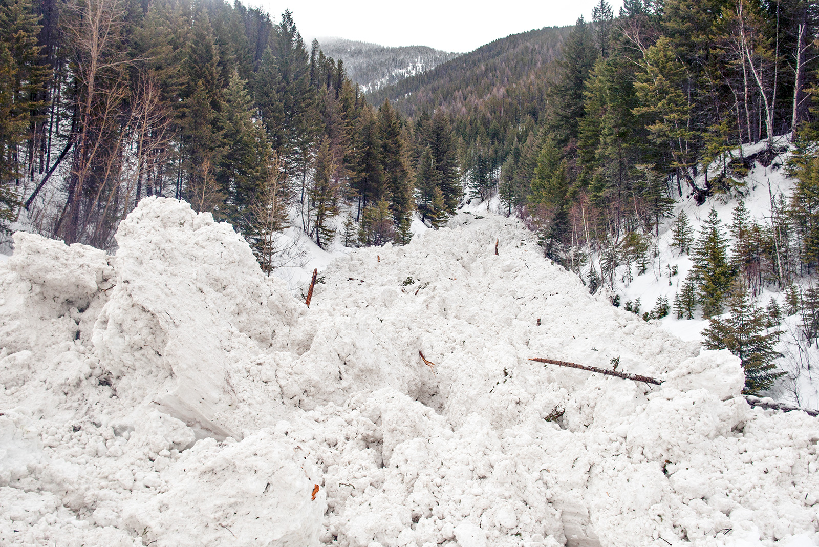
The Flathead Avalanche Center (FAC) today has issued a backcountry avalanche warning in Lake, Lincoln and Flathead counties as warm temperatures continue to increase avalanche danger, according to a U.S. Forest Service news release.
Forecasters say the avalanche danger will rise to “high” today in the Whitefish, Swan and Flathead ranges in addition to areas in Glacier National Park and near Marias Pass. The warning expires on Tuesday morning at 7 a.m.
Prolonged warming with high elevation temperatures forecast in the 30s and 40s through the week, along with overnight lows above freezing, could result in dangerous avalanche conditions. Slides could run long distances into mature forests, valley floors or flat terrain and experts warn that travel in avalanche terrain is not recommended.
According to the Jan. 29 FAC forecast, weather stations at mid elevations recorded air temperatures above freezing for the past 48 hours with about a half-inch of rain recorded in some locations.
“Freezing levels are forecast to climb higher today, possibly to near 10,000 feet,” FAC Director Blase Reardon wrote in today’s forecast.
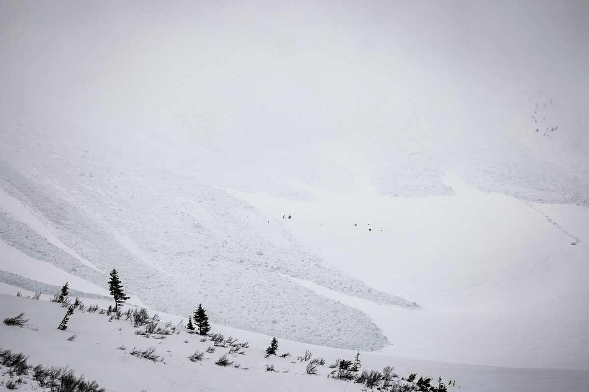
Large wet snow avalanches are likely on steep slopes at mid and upper elevations as wet snow and meltwater add significant stress to the snowpack.
Warm temperatures will persist this week as a ridge of high pressure strengthens today before it heads east with high temperatures expected to reach 40 degrees above 6,000 feet, according to the forecast.
The high-pressure system will result in inversions and dense fog and isolated freezing rain in northwest Montana’s valleys with localized black ice overnight, according to the National Weather Service.
Meteorologists also warn the public of urban snowmelt and runoff through the week and to prepare for standing water on roads as high temperatures reach the 40s and 50s.
Low pressure systems are expected to return on Friday through the weekend, with snow levels dropping to valley floors by Sunday.
“The fever breaks at the end of the week,” Reardon wrote.
Snowpack levels remain well below average with the Flathead river basin at 69% of the median, the Kootenai basin at 71% and the Sun-Teton-Marias at 37%.
For more information and the latest updates, visit www.flatheadavalanche.org.