Montana Water Supply Forecast Remains Grim
Near-average January precipitation in northwest Montana was not enough to erase water supply deficits in Flathead, Kootenai river basins
By Micah Drew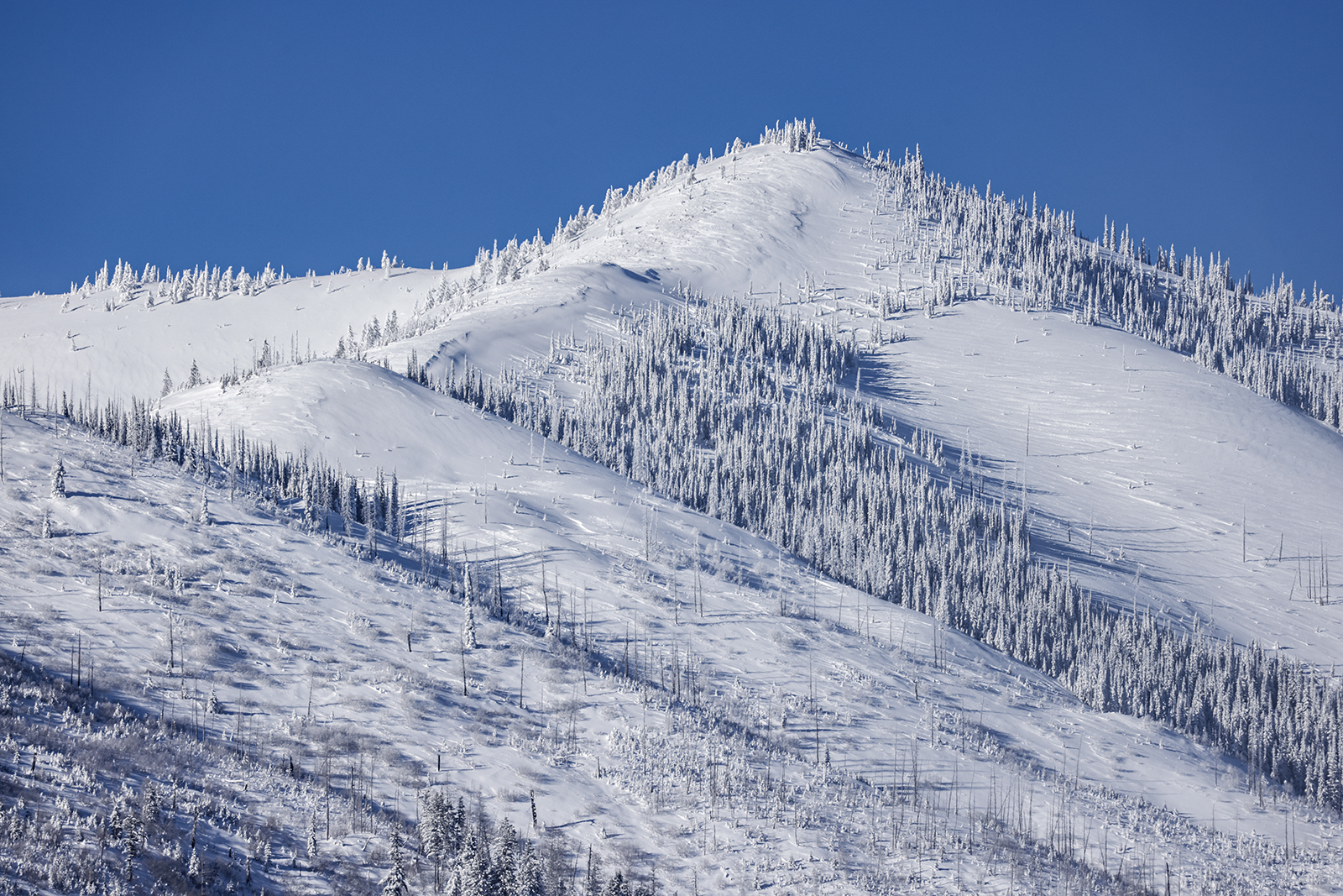
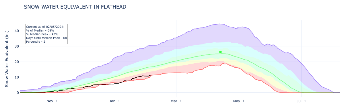
Water supply specialists have pegged snowpack totals in the Flathead and Kootenai river basins at less than 70% of the 30-year average, which is significantly lower than this time last year even as the region has registered the most precipitation of anywhere else in Montana this winter.
That’s according to experts with the U.S. Department of Agriculture’s Natural Resources Conservation Service (NRCS), which released its February Water Supply Outlook Report on Monday.
As of Feb. 1, the snow-water equivalent (SWE) in the Flathead River Basin was 66% of normal, while the Kootenai basin reached 67%. SWE, rather than snow depth, is the measurement used to gauge the amount of liquid water contained within snowpack which will be released when the snowpack melts, playing a key role in agriculture, hydropower production, water storage, aquatic ecosystem health and recreation such as boating and fishing, as well as flood and drought forecasting.
SWE reached 60% for the Bitterroot Basin, and remains at less than 50% for the Sun-Teton-Marias, Upper Missouri, and Upper Clark Fork Basins.
Eric Larson, water supply specialist for NRCS, said that while the Flathead and Kootenai basins received near-normal precipitation in January, it wasn’t enough to make up for deficits seen in the water supply since October, when the water year begins.
“Well above normal precipitation was needed to begin a recovery from lack of snow, yet precipitation was mostly below normal across Montana last month,” Larson said in a press release. “More than half of NRCS snow monitoring stations recently measured for Feb. 1 remain at either their lowest or second lowest snowpack on record.”
The Whitefish Mountain Range received a boost from a mid-January storm that dumped nearly 3 feet of snow at higher elevations — nearly doubling the region’s snow depth and bringing water-year-to-date precipitation in the Flathead basin up to 77%. However, Larson said that lower mountain elevations in the region are still experiencing a SWE deficit of 3 to 5 inches. Since snow falls at a roughly 10% density, upwards of 50 inches of snow is needed to attain normalcy. Upper mountain regions such as Glacier National Park need between 70 and 100 inches to reach normal levels.
Larson notes that, historically, years where specialists observe a relatively low Feb. 1 snowpack do not often see a recovery to normal. In 2003, 2011, 2014, 2017 and 2018, major weather changes that brought “well above normal” precipitation in February through April helped bring snow accumulation into the expected range.
“A three-month repeat like one of those years will be necessary to make gains by May 1,” Larson said. However, “to rely on record high precipitation isn’t ideal.”
Any region of the state that receives normal, or below-normal precipitation for the remainder of the winter will see correlated streamflows below normal during the spring and summer months, which could lead to a cascade of agricultural, recreational and economic impacts as seen last summer when Flathead Lake sat well below full-pool elevation.
“The good news is, a winter storm is on the horizon, which will hopefully add to the snowpack across Montana in the coming days,” Larson said.
According to the National Weather Service there is a 20-40 percent chance of snow for the Flathead Valley beginning on Wednesday and continuing through the weekend.