Northwest Montana Snowpack Remains Low Despite Winter Storm
The Flathead River Basin is at 66% of normal snow water equivalent; basins east of the Continental Divide remain below 50%
By Denali Sagner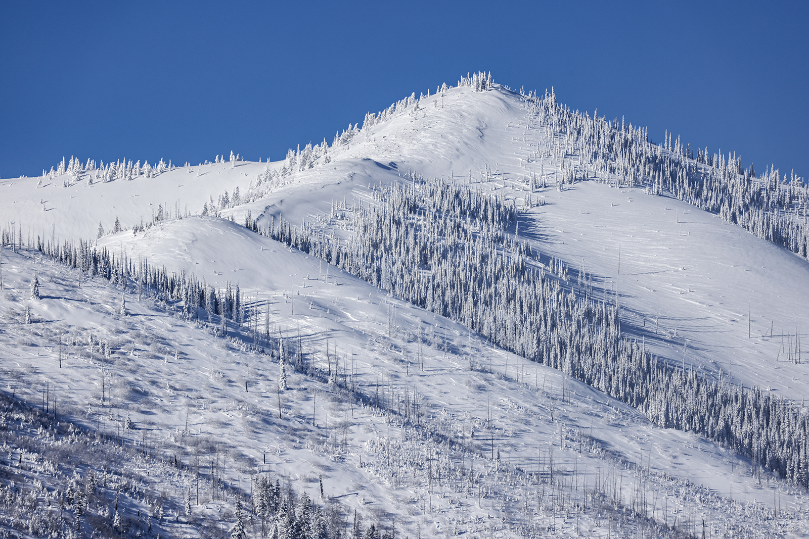
Despite a winter storm that dumped record levels of snow across northwest Montana last week, snowpack levels continue to lag in the region, signaling concerns that a hot, dry summer may lie ahead.
As of Friday, the snow water equivalent (SWE) in the Flathead River Basin had reached 66% of normal levels. SWE measures how much water the snowpack contains, or the depth of water that would cover the ground if the snow was in a liquid state. SWE reached 70% of normal for the Kootenai Basin, 60% for the Lower Clark Fork, 48% for the Upper Clark Fork and 64% for the Bitterroot. On the east side of the Continental Divide, conditions are even drier, with the Sun, Teton and Marias river basins at 39% of normal SWE.
Eric Larson, water supply specialist for the U.S. Department of Agriculture’s Natural Resources Conservation Service, said the recent storm certainly helped raise snowpack levels, which were sitting below 50% across most of Montana prior to last week.
Between Wednesday and Thursday of last week, 19.5 inches of snow fell in Columbia Falls, 18 inches in Eureka, 14.5 inches in Bigfork and 9 inches in Kalispell and Whitefish.
Dave Noble, meteorologist with the National Weather Service (NWS), said that near record-breaking levels of snow fell on the Flathead during the recent blizzard. The highest snowfall ever recorded by NWS in Columbia Falls was 20 inches in 1917.
NWS issued a blizzard warning on Wednesday morning for the Flathead Valley and surrounding areas. Noble said it’s “very rare” for the weather service to issue a blizzard warning, calling the storm “pretty historic.”
Whitefish Mountain Resort spokesperson Chad Sokol said the weather event helped bring the mountain close to full coverage after a slow start to the season marked by warm temperatures and minimal snow.
“We definitely feel like our fortunes changed these past couple of weeks with the snow we got,” Sokol said.
Yet it will require continued snowfall to make up for the low SWE levels across the region — snowfall that, with an El Niño winter weather pattern and a warming climate, may not arrive.
“While this recent snow is certainly helping chip away at that snowpack shortage, it’s still behind normal percentages,” Larson said.
The hydrologist said that lower mountain elevations in northwest Montana are experiencing a 2- to 4-inch SWE deficit, which means 20 to 40 inches of snow would need to fall to reach normal levels. Upper mountain elevations in Glacier National Park are seeing 5-inch deficits, requiring 50 inches of snow to attain normalcy.
The onset of El Niño, a weather pattern that occurs every two to seven years and which is currently passing through the Mountain West, means the rest of the winter will likely be warmer than average. Forecasters this fall anticipated winter in northwest Montana would be 2 to 4 degrees warmer than normal, with precipitation anomalies at as much as 75% to 90% below normal.
The mean temperature in Kalispell last month was 29.3°F, compared to 17.3°F in December 2022.
The warm temperatures associated with El Niño are compounding with warmer winters that are the product of climate change. Between 1950 and 2015, the average temperature during winter in Montana rose by 3.9°F, according to the Montana Climate Assessment.
Noble said the recent storm was an anomaly during a winter that is predicted to be warmer and rainier than usual. The meteorologist said there is some indication that there could be a cooler, snowier period settling in by the second week of February, though it is hard to pinpoint exactly what the weather pattern will bring to the Flathead Valley.
If SWE levels remain below normal, a hot, dry summer and wildfire season may be on the horizon for the region.
Larson explained that snowpack plays an important role in Montana and the western United States and provides the region with much of its water supply, well into the summer months. If snowpack levels remain low, or if an unseasonably warm spring melts off much of the snow stored in the mountains, Montana’s forests could become dangerously dry within weeks of summer’s start.
“It’s still too early to really be concerned about what spring runoff will be,” he said. “But, certainly, the lack of snowfall now and earlier in the season is going to require above normal precipitation later.”
Noble said that while winter may seem normal when there is snow on the ground, long-term seasonal trends raise concerns for meteorologists.
“Winter’s still going to happen like we just experienced, but when you look at the three-month average, it’s going to be below average,” he said.