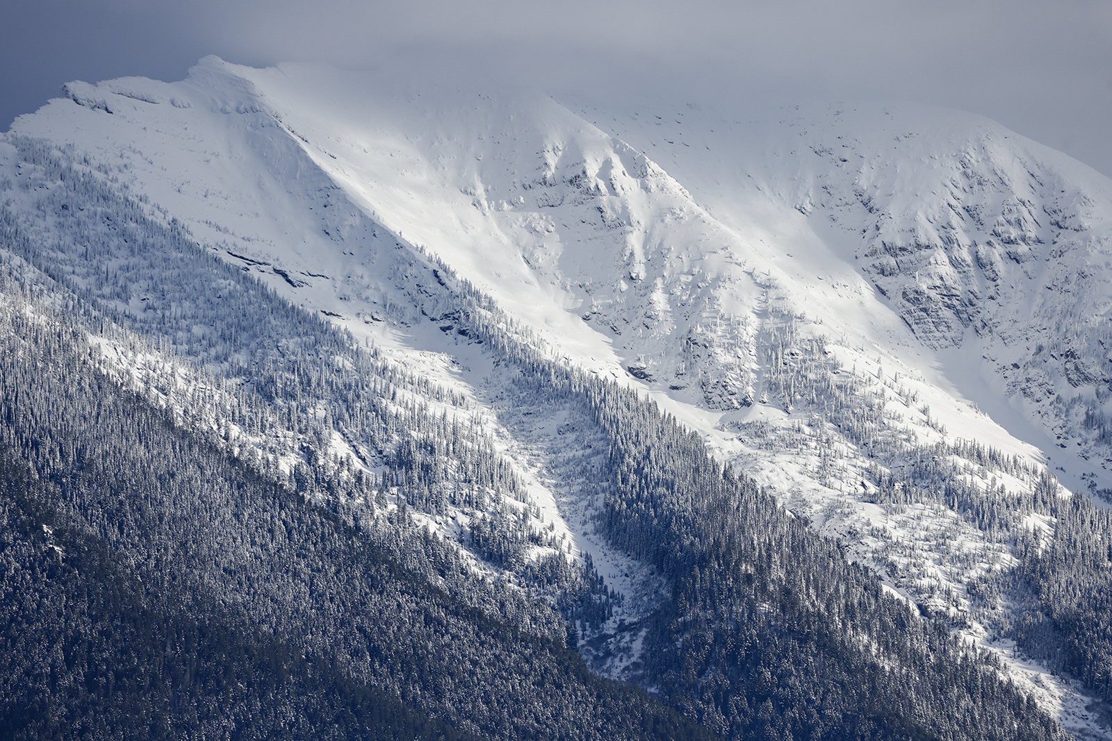
An October storm is on tap to blanket northwest Montana’s mountains with high-elevation snow over the weekend after what could be the final warm, bluebird days this afternoon and tomorrow. So, make sure you take advantage of today’s vitamin D and harness the power of the sun while it’s still here, which for now pokes out for barely 11 hours as we continue losing about 3 minutes of rays per day.
The National Weather Service – which is still operating amid the government shutdown – forecasts winter’s arrival on Saturday with close to an inch of rain in Kalispell while high elevations along the Continental Divide could see 8 to 36 inches of snow by Monday evening and 6 to 24 inches in the Swan, Mission and Whitefish ranges.
Glacier National Park officials yesterday reopened the Going-to-the-Road from West Glacier to St. Mary, lifting the partial closures that were enacted Oct. 4 after snow accumulated on Logan Pass last weekend. So, be on the lookout for closure alerts as the weekend nears.
The cold and precipitous weather comes on the heels of the Climate Prediction Center’s Oct. 9 report of a weak La Niña Advisory after its characteristics emerged last month, which are “favored to persist from December 2025 through February 2026.”
During La Niña events, stronger-than-usual winds push warm water toward Asia and an “upwelling” brings cold, nutrient-rich water to the surface off the west coast of the Americas. The cold waters in the Pacific push the jet stream north, typically causing a drought in the southern United States with heavy rains and flooding in the Pacific Northwest and Canada along with cooler weather in the north.
The longest recorded La Niña lasted 37 months from the spring of 1973 through 1976, which contributed to the second highest crest on the Middle Fork Flathead River recorded at 19.42 feet on June 20, 1975. By comparison, this year’s crest was only 6.38 feet on May 12.
La Niña will have significant ground to cover after an abrupt runoff this spring and a warm and dry fall triggered low streamflows across the state. More than a dozen U.S. Geological Survey (USGS) river gage sites west of the Continental Divide, which include the Middle Fork Flathead River at West Glacier and Fisher River in Libby, hit record lows in September.
As of Oct. 9, the Middle Fork read 314 cubic feet per second (cfs) compared to its median flow of 735 cfs for that date while Fisher River reported 52 cfs compared to the median of 108 cfs, according to USGS data, which is currently being “updated with limited support” during the government shutdown.
Local Watchdog Group, Tribes Lead Effort to Block Expansion of Wastewater Treatment Plant
Citizens for a Better Flathead and the Confederated Salish and Kootenai Tribes are seeking a preliminary injunction to halt the Lakeside County Water and Sewer District's discharge. A separate lawsuit alleges the sewer district violated public participation laws.
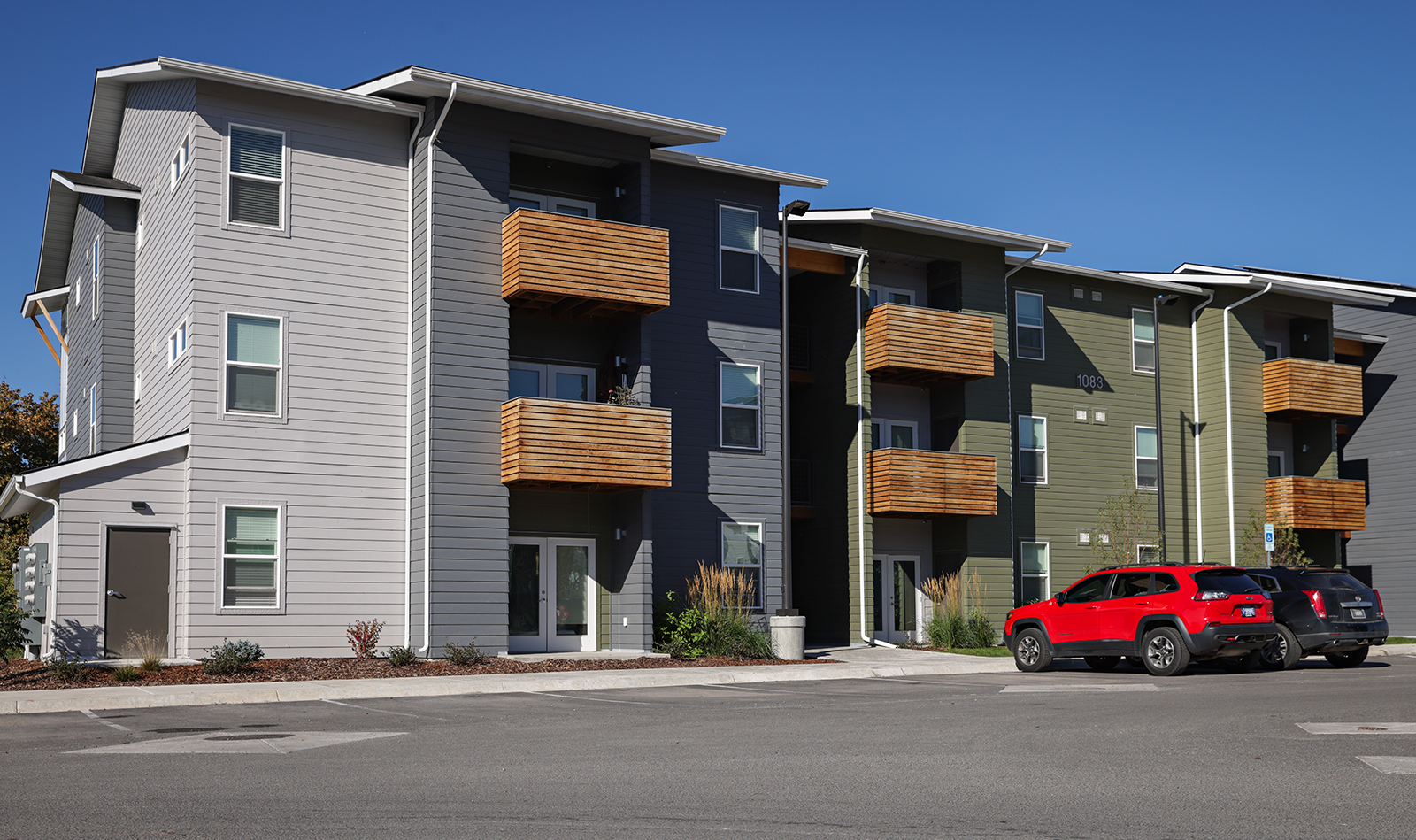
Junegrass Place Brings Low-income Housing to Kalispell
The 138-unit development utilizes federal housing tax credits through the Montana Board of Housing to offer affordable apartments on North Meridian Road
In her latest column, Bigfork-based cookbook author and food blogger Julie Laing shares her recipe for fresh pear, goat cheese and rosemary galette. Check it out here.
Keeping you connected to Northwest Montana.
Whether you’ve been here for decades, or you’re new to the Flathead Valley, our reporting is here to help you feel smarter and in the loop about the issues most important to Northwest Montana. With your support, we can build a more engaged, informed community.