Snowpack Levels Remain Near Average in Northwest Montana
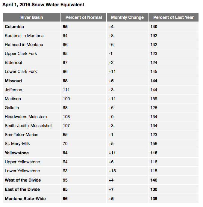
The snow water equivalent levels in the Flathead River Basin are at 96 percent of normal
By Beacon Staff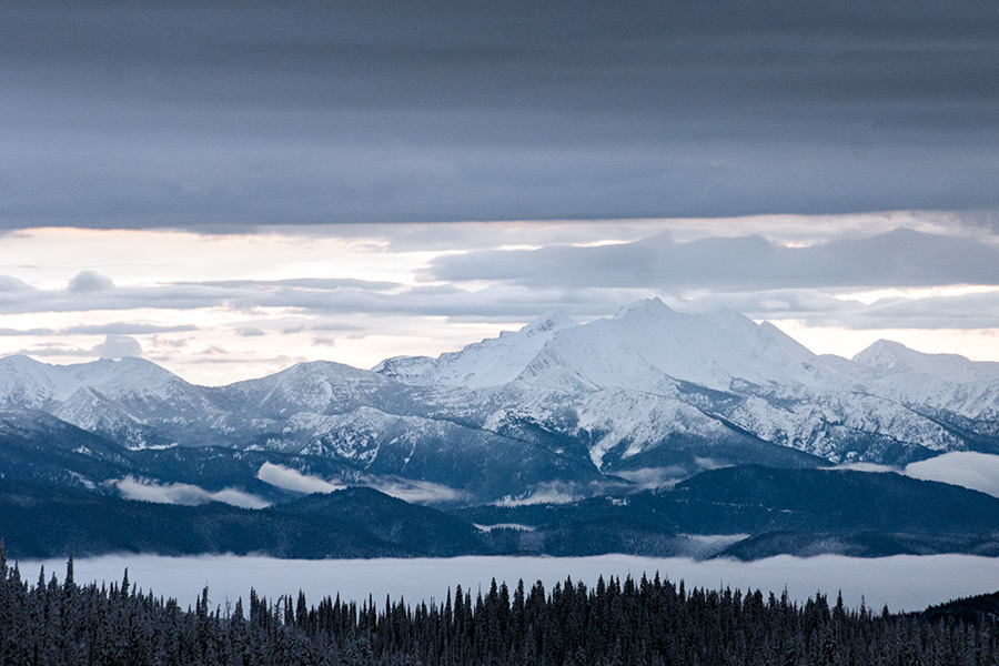
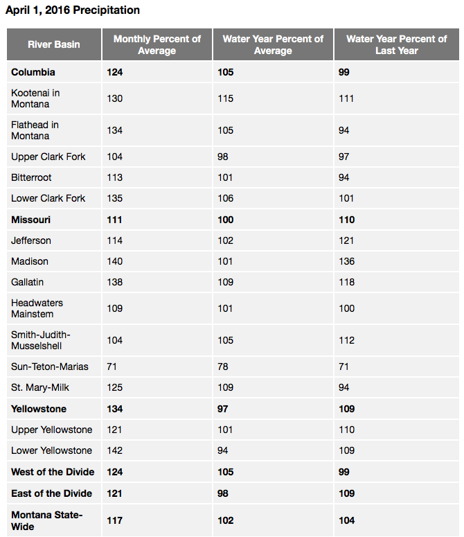
Snow at the higher elevations and rain in the valleys yielded near- to above-average precipitation during March in all but one of Montana river basins, according to data from the USDA’s Natural Resources Conservation Service.
The snow water equivalent levels in the Flathead River Basin are at 96 percent of normal, according to USDA data. The measurements show 132 percent more than this time last year.
In the Kootenai, snow water equivalent levels are at 94 percent of normal and 192 percent more than last year.
In the Rocky Mountain Front, this year’s lack of snowfall has resulted in well below average snowpack in the Sun-Teton-Marias River basin, which is 70 percent of normal for April 1.
“As snowpack gradually melts, it provides water over a long period of time, and can be considered the largest reservoir in the state,” said Lucas Zukiewicz, NRCS water supply specialist.
Basins west of the Continental Divide received 124 percent of average precipitation during March, and river basins east of the Divide received 121 percent above average precipitation.
“Snowpack in the state typically peaks sometime during the coming month,” Zukiewicz said. “April 1, measurements are a good indicator of water available this coming runoff season.”
Basins like the Sun-Teton-Marias, which are below normal in snowpack for this date, will need to see a major change in the weather patterns in order to add to this reservoir before spring melt and runoff.
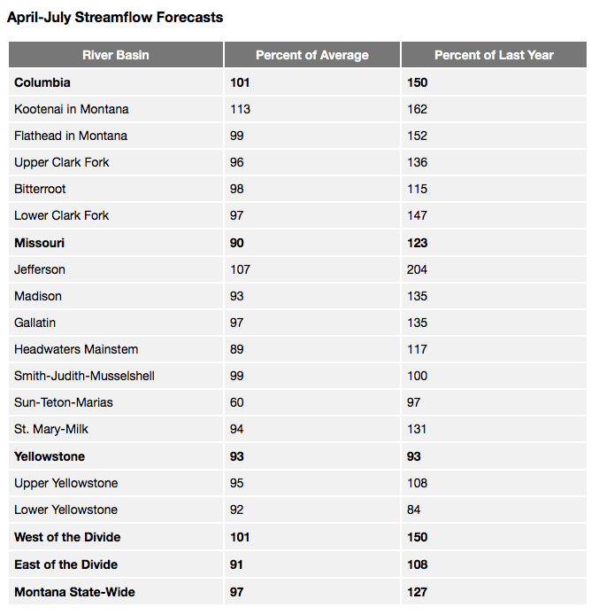
April-June are critical across the state, and in some basins, the bulk of precipitation is received during this time period. Basins that are in good standing snowpack-wise can see further increases during this time, and basins that are below normal can make some recovery. As of April 1, all of Montana’s major river basins have exceeded the amount of snow water at peak accumulation during this time last year.
“The snowpack in most of our basins is looking good, but last year was a great illustration of how important spring is to our reservoir system and rivers,” Zukiewicz said.
At this time last year, snowpack appeared to be in good shape before spring, but below average precipitation during March-June resulted in below average flows in our rivers last summer and fall. Given current conditions and assuming normal precipitation and temperatures over the next three months, this year looks to be different.
Long duration streamflow forecasts have improved from last month across the state and are near to slightly above average for the April-July time period. Most rivers look to see near normal river flows this spring. However, some water users should be prepared for below average streamflows unless conditions change in the Sun-Teton-Marias and Tongue River basins.
“May 1, measurements and forecasts should give water users a good idea of the peak snowpack this year, and hopefully will show some recovery in those basins that are below normal,” Zukiewicz said.
Source: USDA’s Natural Resources Conservation Service