The Latest
-All five fires 100 percent contained
-Command shifting back to DNRC
-Half the personnel have already left
Updated: July 19, 9:45 a.m.
Fire crews have contained all five fires in the U.S. Highway 2 corridor west of Kalispell, according to an update from the interagency team managing the wildfires.
“This will be the final update,” the Thompson’s Type II Incident Management Team said on July 19, now that all five fires are 100 percent contained.
Command will transfer back to the state Department of Natural Resources and Conservation at 6 a.m. on July 20. A Type-III organization will manage the Rogers Mountain and Lazier Creek 3 fires, and the other three fires will be transferred to the DNRC Kalispell and Libby units.
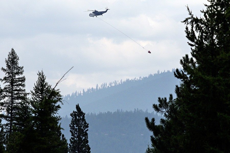
The fires, which once involved more than 480 personnel, now only need about half, with 248 people still posted as of July 19.
Crews expect the hot and dry weather to continue on Wednesday, with a weak cold front bringing more winds on Thursday. According to the National Weather Service, conditions will continue to be very dry due to decreasing humidity, causing fire danger to increase further Thursday.
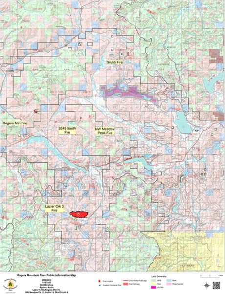
Lazier Creek 3 Fire: Burned 1,145 acres, located south of Highway 2 and west of Thompson River Road. Crews will continue removing hose and other equipment from secure areas of containment line. Resources – including 204 personnel as well as engines – will remain on scene to patrol fire.
Rogers Mountain Fire: Burned 78 acres, located three miles north of Happy’s Inn in Marion. Resources will continue to patrol the fire.
Grubb Fire: Burned 16 acres, located north of Pleasant Valley. Three personnel remain on scene to patrol fire.
NW Meadow Peak Fire: Burned 12 acres, located northwest of Meadow Peak Lookout. Four personnel assigned to patrol the blaze.
2645 Fire: Burned 4 acres, located just northwest of the NW Meadow Peak Fire. Resources will patrol the fire.
FIRE MAP: