This story was last updated on Aug. 16. Click here for the latest wildfire news from Northwest Montana.
—Howe Ridge Fire grows to 3,500 acres
—Type 1 incident management team to take command at 6 a.m. Friday
—Evacuation warning issued for community west of Essex
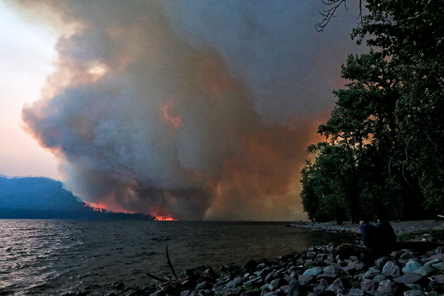
The wildfire that has destroyed numerous homes and forced the evacuation of a section of Glacier National Park grew to 3,500 acres on Wednesday.
The Howe Ridge Fire has been tormenting the west side of the park since it exploded on Aug. 12 from a 20-acre fire to a 2,500-acre inferno, destroying seven private residences and a number of historic buildings. Since then, firefighters have been focusing their efforts on protecting other structures on the north end of Lake McDonald.
The Southwest Area Type 1 Incident Management Team under the command of John Pierson arrived in the area on Wednesday and will be taking over management of firefighting efforts at 6 a.m. Friday. Nearly 80 firefighters are assigned to the fire today.
On Wednesday, helicopters dropped water on the fire to slow its growth. Fixed wing “Super Scooper” airplanes have been unable to drop water on the fire because of low visibility. Evacuated landowners were able to access their property on Wednesday morning.
Today, the high-pressure system that has dominated the weather in recent days is expected to break down in the afternoon resulting in changing winds. Glacier National Park officials say the fire could move to the southwest and the northeast. Firefighters are hoping to lay hoses at the north end of Lake McDonald to prevent the fire from heading east toward the Going-to-the-Sun Road and other pieces of infrastructure.
The Lake McDonald Lodge area, the Avalanche and Sprague campgrounds and the North Lake McDonald Road have been evacuated. The Going-to-the-Sun Road remains closed from Apgar to Logan Pass.
Stage 2 fire restrictions are in effect for Glacier National Park and much of Northwest Montana. Campfires and smoking outside are prohibited.
Outside of Glacier National Park, at least a half-dozen major wildfires are burning across the region. An evacuation warning was issued Wednesday for an area west of Essex as the Paola Ridge Fire continues to creep toward U.S. Highway 2. The evacuation warning includes homes along U.S. Highway 2 between mile markers 176 and 179, and Branch Road, Bugling Elk Trail, Dickey Creek Loop, Eagle Haunts Run, and Lazy Moose Trail. As of Thursday morning, the fire has burned 400 acres. Firefighters are working on constructing strategic firebreaks to stop the fire from impacting populated areas, but the blaze is expected to grow over the next few days.
The Coal Ridge Fire near Polebridge has burned 266 acres as of Thursday morning. East of Lake Koocanusa, the Sterling Complex Fire has burned 907 acres on the Kootenai National Forest. Just west of that blaze, the Ten Mile Fire has burned 681 acres and was 91 percent contained as of Thursday morning. The Davis Fire near Yaak was listed at 5,724 acres and was still burning into Canada.
This story will be updated when additional information becomes available.
