Wildfire Update: Garceau Fire Expands as Blazes Force Recreation Closures in Glacier Park, Bob Marshall Wilderness
Garceau Fire near Hot Springs adds 2,000 acres while other nearby blazes see minimal growth
By Micah Drew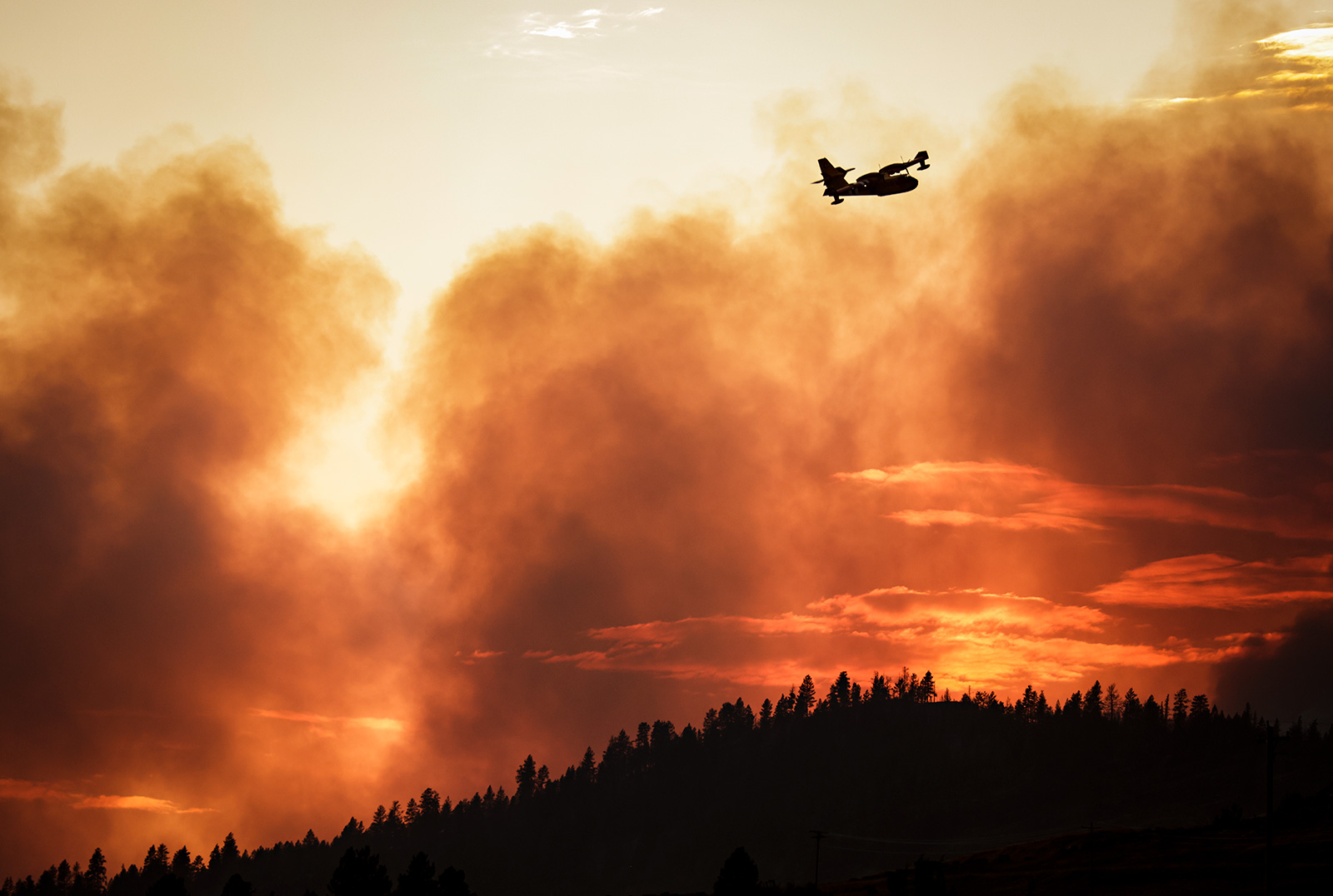
The Elmo Fire burning near Lake Mary Ronan, which just weeks ago was the top priority in Montana, is mostly a smoldering swath of burnt land. The fire is at 78% containment and remains at 21,349 acres.
A local Type 4 firefighting crew took over command of the fire on Thursday. Crews will continue patrolling the fire and mopping up containment lines. Interior smoke will likely continue to be visible in the area. The cause of the fire is still under investigation.
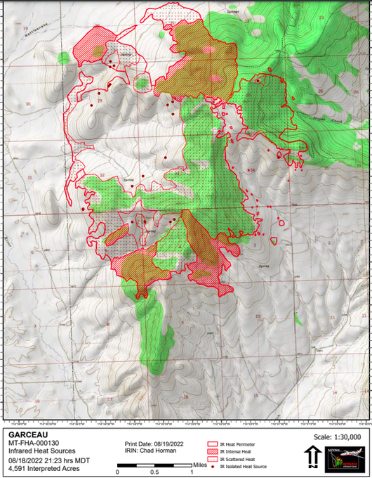
A few miles north of Hot Springs, the Garceau Fire expanded rapidly over the last 24 hours, adding nearly 2,000 acres. Overnight infrared mapping showed the fire perimeter at 4,591 acres, with the fire growing by about a mile to the north and to the south. There are currently 265 personnel assigned to the operation along with substantial aerial support.
As of Friday morning, there are no evacuations in place and no structures are threatened. Road closures include Irvine Flats and Garcon Gulch Roads going up to Windy Gap except for local traffic.
Firefighting crews are working to complete dozer lines on the western and northern edges of the fire, but progress is slow due to the steep rocky terrain.
The Redhorn Fire, burning seven miles northeast of St. Ignatius in the Mission Mountain Tribal Wilderness, has seen minimal growth in recent days. McDonald Lake reopened to day-use recreation on Friday, but the area south of the lake remains closed to all recreation due to grizzly bear habitat through Oct. 1.
Lake County and the Flathead Indian Reservation remain in Stage 1 Fire Restrictions.
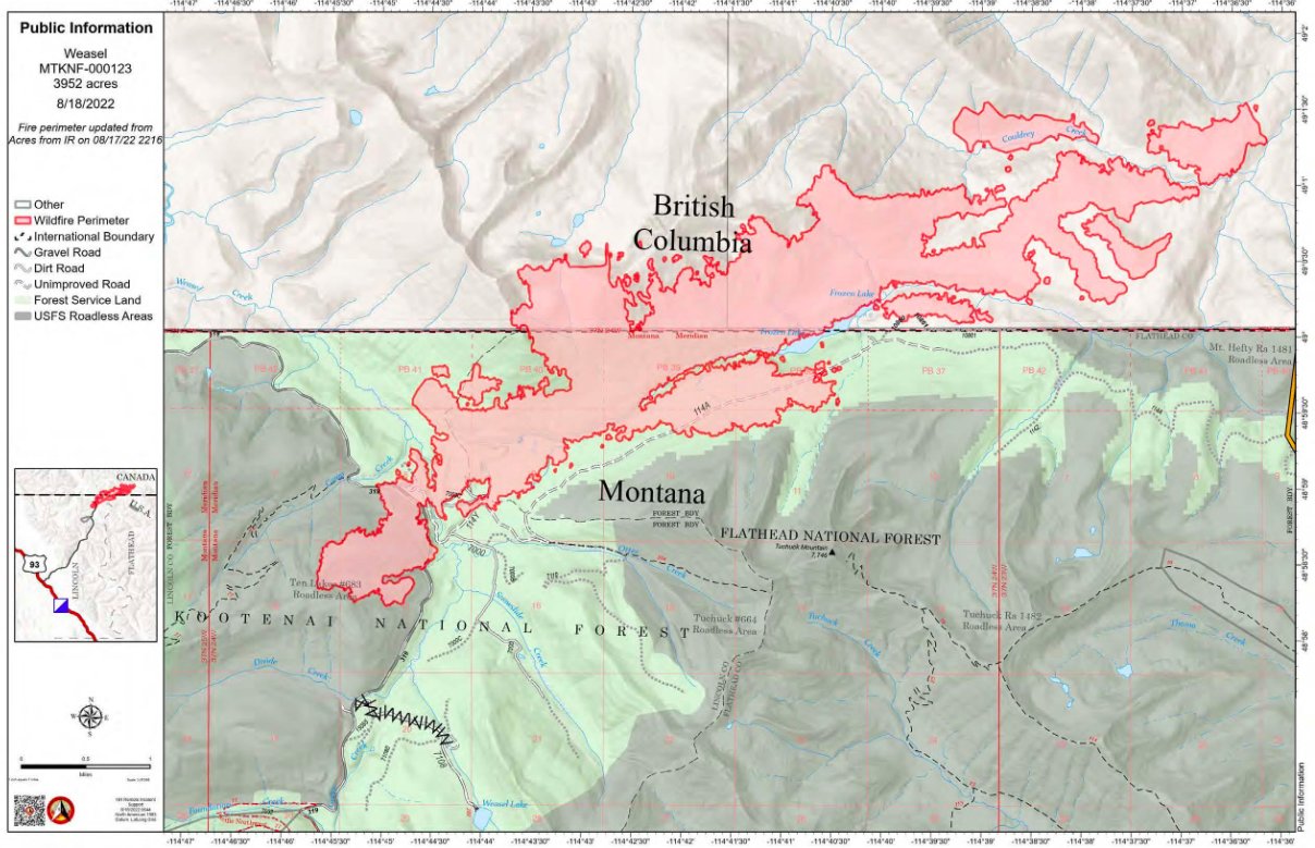
Up in Canada, the Weasel Fire, which was discovered burning in the Flathead and Kootenai National Forests on July 30, has grown to just over 4,200 acres. Approximately 2,700 acres are actively burning in British Columbia.
The lightning-cause fire is burning in remote, inaccessible wilderness and saw around 250 acres of growth to the northeast into the Couldrey Creek area of British Columbia
Vast recreation restrictions are in place in B.C. through October 15 to protect the public where fire suppression activities are taking place.
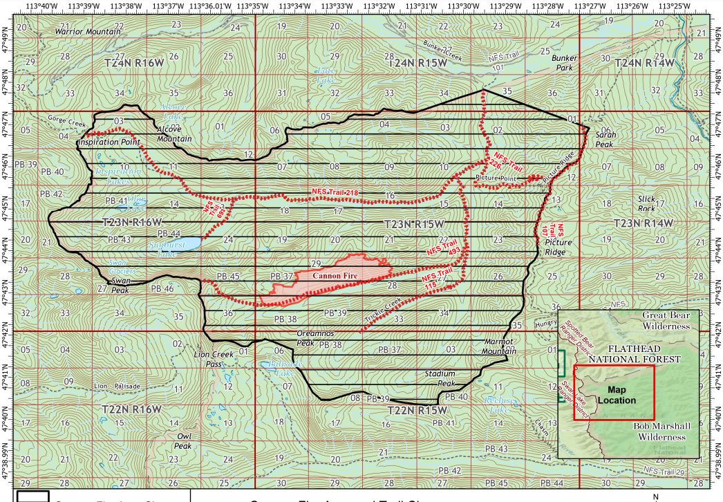
In the the Spotted Bear Ranger District of the Bob Marshall Wilderness the Cannon Fire, first detected on Aug. 7, has grown to nearly 1,000 acres, prompting recreation closures in the area.
Portions of Forest Service Trail #107, 115, 218, 226, 493, and 693 are closed in the area. A map identifying the closure area can be found online and seen below.
The first overnight infrared flight of the Quartz Fire measured its perimeter at 802 acres Friday morning. The blaze has prompted trail and backcountry campsite closures in Glacier National Park.