Flathead County Designated Primary Natural Disaster Area
The United States Department of Agriculture designated two Montana counties as primary natural disaster areas due to drought conditions
By Micah Drew
The Secretary of Agriculture designated two Montana counties as primary natural disaster areas on Monday due to recent drought conditions in the region.
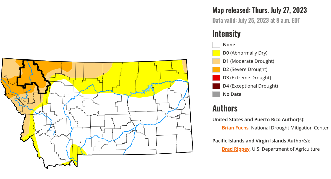
In response to a request made by Gov. Greg Gianforte last week, Secretary Tom Vilsack designated Flathead and Lincoln counties as primary natural disaster areas, in accordance with the Consolidated Farm and Rural Development Act. According to the U.S. Drought Monitor, a portion of the two counties has had a drought intensity level of “D2-Drought-Severe” since the beginning of May.
Under a disaster declaration, farm operators within the counties are eligible for Farm Service Agency emergency loans assistance, as long as they meet specific requirements. Farmers have eight months from the declaration date to apply for emergency loans, which are considered based on the extent of production losses on the farm and the security and repayment ability of the operator.
Glacier, Lake, Missoula, Lewis and Clark, Pondera, Powell, Sanders and Teton counties are designated as “contiguous counties,” which offers the same access to federal aid as primary counties.
The governor’s request came on the heels of a request from the Flathead County commissioners seeking state disaster declarations for both Flathead and Lake counties to alleviate the economic impacts of Flathead Lake’s historic low water levels.
As of Monday afternoon, Flathead Lake’s surface elevation was 2890.71 feet, more than two feet below the lake’s full pool level — and a foot below the historic record — according to U.S. Geological Survey (USGS) data. The low water levels cross the region have impacted agricultural businesses including by draining part of Egan Slough along Flathead River, a body of water that irrigate several local farms. The main stem of the Flathead River registered a flow rate of 3,640 cubic feet per second, less than half the median flow rate for this time of year.
Last week the Daily Montanan reported that at the time Gianforte sent his letter to Sec. Vilsack requesting the federal disaster designation, three Montana counties — Lake, Glacier and Pondera — were already designated as primary natural disaster counties, while seven additional counties, including Flathead, were designated as contiguous counties according to a June 26 letter sent from Vilsack to the governor. According to the Daily Montanan, the governor’s office erred by citing data from the National Integrated Drought Information System’s website for Montana rather than the U.S. Department of Agriculture.