Statewide Snowpack No Longer Lowest on Record, but Still Grim
The latest USDA Water Supply Report shows February storms helped statewide snowpack recover, but not enough to alleviate worries of a dry summer
By Micah Drew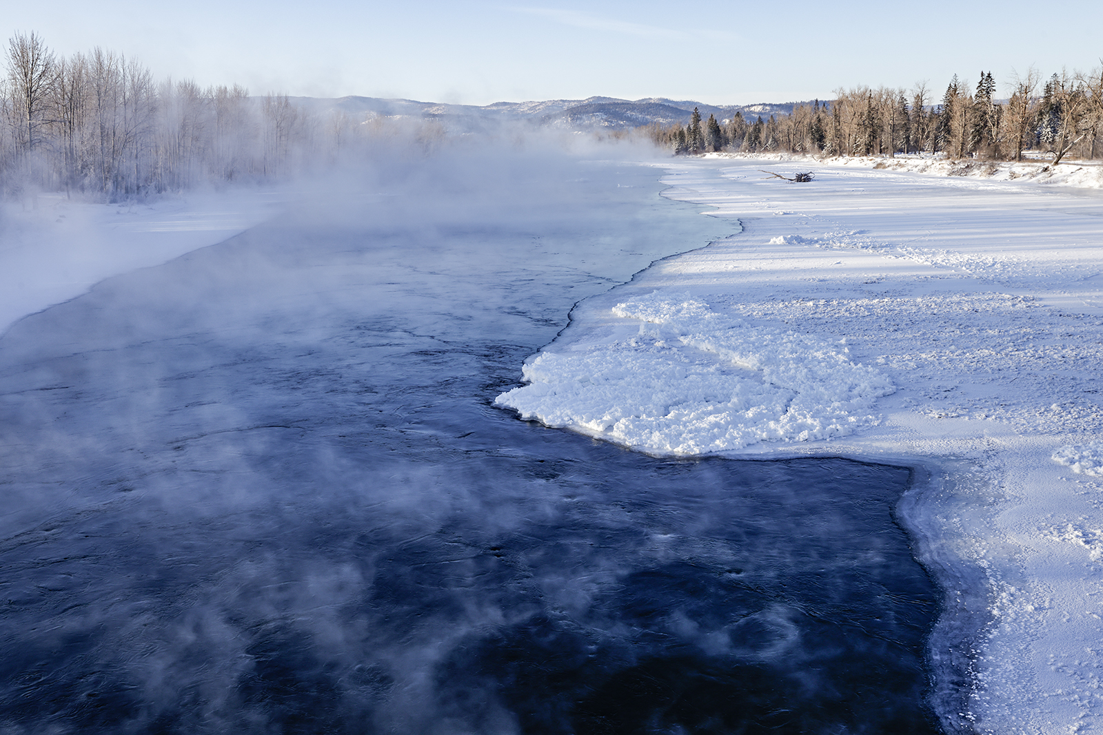
February storms delivered above-average precipitation across Montana, including in the Flathead and Kootenai river basins, which saw monthly precipitation at 116% of the 30-year median. However, water supply specialists say widespread winter-long deficits will require substantial snowfall between now and mid-May, when snowpack typically peaks in Montana’s higher elevations
That’s according to the U.S. Department of Agriculture’s Natural Resources Conservation Service (NRCS), which released its March Water Supply Outlook Report on Wednesday.
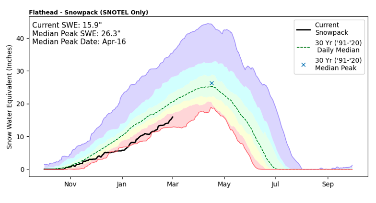
As of March 1, the snow water equivalent (SWE) in the Flathead River Basin was 72% of normal, while the Kootenai basin was recorded at 76%, a much-needed increase from last month’s reports of 66% and 67% respectively. Snow-water equivalent, rather than snow depth, is the measurement used to gauge the amount of liquid water contained within snowpack, which will be released when the snowpack melts, playing a key role in agriculture, hydropower production, water storage, aquatic ecosystem health and recreation such as boating and fishing, as well as flood and drought forecasting.
“The good news is widespread precipitation brought an increase in snowpack percentages in all of Montana’s river basins from last month,” said Eric Larson, water supply specialist for NRCS, adding that early March storms continued the trend. However, “widespread deficits remain. While not as many NRCS snow stations are reporting their lowest snowpack on record compared to last month, 200 of about 255 stations still have a snowpack in the 25th percentile or less for their period of record.”
On Feb. 1, more than half of the state’s snow monitoring stations were recording either all-time lows or the second lowest snowpack, based on data going back several decades. While no river basins in western Montana are currently exceeding SWE of 77%, only a few are still at record low levels.
In the Flathead basin, February’s above-average snow accumulation marked the first month since October that the basin’s water supply deficit hasn’t worsened. The snowpack in the region still lags behind last year’s numbers at the beginning of March — 72% compared to 94% — with the largest deficits seen at the highest elevations. In the Cabinet, Swan and Mission ranges, SNOTEL sites are measuring snowpack between 10 and 12 inches below normal, though data doesn’t account for storms in the last week.
“Monthly snowpack percentages are derived from a combination of data from automated SNOTEL sites and manually measured snow courses, and don’t reflect the most recent storm,” Larson said in a press release. “March, April and May can be a very active time of the year for winter weather in Montana, which is good because winter weather needs to continue for a couple more months.”
As water specialists continue to analyze new data each month, they are able to adjust their forecasts for spring and summer streamflows. Currently, streamflows in Montana between April and July are forecast to be between 60% and 80% of normal.
At this time last year, hydrologists were anticipating average streamflows in Northwest Montana before a rapid spring warming melted the snowpack faster than expected, leading to region-wide droughts and record-low levels of Flathead Lake.
Forecasts published on April 1 and May 1 will provide a better indication of what the upcoming season will bring, according to Larson, who emphasized that the water supply reports only provide a snapshot on a given day.
The NRCS report states that over the last 10 years, March and April snow accumulations have been below average three times, and above average three times. While average precipitation over the next few months would help the overall situation throughout Montana, “above normal precipitation would be better.”