User Capacity Among Public’s Concerns as Flathead River Management Plan Update Proceeds
At open houses hosted by the Flathead National Forest on Jan. 21 and Jan. 22, officials outlined a “proposed action,” which includes potential plans for a mandatory but unlimited permit for all three forks and restrictions that would preserve the Flathead River system
By Maggie Dresser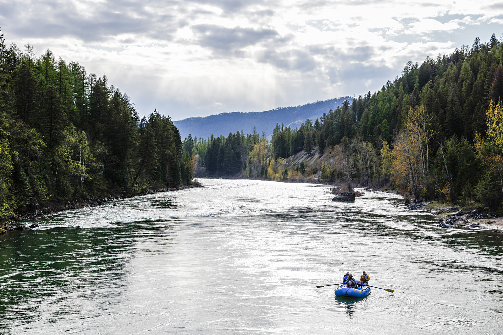
When Carlos Florey moved to the Flathead Valley four decades ago in search of solitude, he was often the only boat on the water while floating various sections of the three forks of the Flathead River system. After raft guiding on the Arkansas River in Colorado and witnessing the evolution of a heavily guided section of water, he moved north and has enjoyed boating on the Wild and Scenic Act-designated river system ever since.
“One reason I left was because it became bumper boats,” Florey said. “You could literally walk upriver from boat to boat.”
Florey was one of about 100 people who attended a Jan. 22 open house at Flathead Valley Community College designed to educate the public about the “proposed action” on the long-waited updated river management plan that looks to add new regulations to preserve the North, Middle and South forks of the Flathead River.
While Florey acknowledges that even the most congested river sections like the whitewater stretch from Moccasin Creek to West Glacier on the Middle Fork of the Flathead River don’t compare to places like the Arkansas River, he hopes it never gets to that point. But he says it’s hard to ignore the spike in use he’s seen over the decades.
“Some days you can’t even find a place to pull over and eat lunch because there’s just wall-to-wall people,” Florey said. “I don’t really know what the answer is.”
Following a confluence of factors — including leadership turmoil and a surge in river recreation that was escalated by the Covid-19 pandemic in 2020 — that contributed to a delay in updating the management plan, agencies this month reopened the public engagement portion of the process. Work on the initial Comprehensive River Management Plan (CRMP) and the environmental assessment began in late 2017 and was expected to be released for public comment in early 2020.
Major highlights in the 2025 “proposed action” plan include a mandatory but unlimited permit system for all three forks of the Flathead River; prohibition of motor vehicle camping or parking on gravel bars on all river segments with access adjacent to roads; limited group sizes; and requiring solid human waste containment within 200 feet of the river’s edge.
At the open houses on Jan. 21 and Jan. 22, information about submitting public comment was also provided, which is being accepted until Feb. 7 before the draft river management plan — which is different than the “proposed action” — is completed this summer along with the environmental assessment document. The final CRMP is expected to be released by early next year. Comments can be submitted here.
Designated by Congress in 1976 under the Wild and Scenic River Act, the management plan for the 219 miles of the North, Middle and South forks of the Flathead River was last updated in 1980.
“With this proposed action — we’re not saying we’ve got it all figured out,” Hungry Horse-Glacier View District Ranger Rob Davies told the audience. “We really need your help … we’re here because we love, and we really admire the Flathead Wild and Scenic River. It’s a gem — it’s really something that’s of national significance and there’s no other river like the three forks with our water quality, our fisheries and our values that we have here.”
For the last five years, the Flathead National Forest and Glacier National Park have been updating the CRMP for the river system they cooperatively manage, while evaluating the significant increase of use. Federal legislation requires the agencies to protect the river system using “Outstanding Remarkable Values” (ORV) as a rubric.
Water quality, for example, is considered an ORV that must meet or exceed Montana Department of Environmental Quality standards while the recreation ORV must be met by ensuring access, safety, Leave No Trace techniques and maintaining a “sense of remoteness” and self-sufficiency on certain sections.
“These proposed management actions were developed to help us achieve the desired conditions for these ORVs and our main guiding light on this is that we need to protect and enhance the ORVs,” said Mary Greenwood, the project manager recruited last May to lead the CRMP efforts.
With experience crafting river management plans across the country, including on the Snake River in the West and the Chattooga River in the Southeast, Greenwood joined the local planning effort from the U.S. Forest Service’s Wilderness, Wild and Scenic Rivers Program in Washington, D.C., although she is based in Idaho.
In her role as the U.S. Forest Service’s CRMP Project Manager — a position that was formed last year to give national consistency among river management plans — Greenwood is working to bridge gaps and provide guidance to local agencies.
While the Flathead River system’s management plan has not been updated in more than four decades, Greenwood said its protracted timeframe for completion isn’t unique to northwest Montana, with delays causing similar issues nationwide.
“Since river management plans come maybe once every 40 years, it’s not something that everyone is experienced with,” Greenwood said.
Like other river systems that she has worked on, Greenwood said user capacity is a primary concern among members of the public, which she describes as “an incredibly complex element.”
“The capacity is our best attempt to take all those management actions and all those desired conditions and try and reflect a numerical value that represents what we think that number of use might be before we see degradation in ORVs … it’s really a decision that agencies are making based on our knowledge and our best available science,” Greenwood said.
In the proposed action, the three forks are divided into separate management units curated to offer different types of experiences depending on their Wild and Scenic designation.
For example, the section of the South Fork of the Flathead River that tracks through the Bob Marshall Wilderness Area would be managed differently than the section that does not. On the North Fork, the more remote section that spans from the U.S.-Canada border to Polebridge would be managed to handle fewer users than the section from Polebridge to Camas Bridge.
With a higher concentration of recreationists on this section, officials say they would likely work to mitigate these impacts in the future by adding more access in places like Coal Creek — but stressed this would not be part of the current CRMP. Split jurisdiction also complicates infrastructure improvements on the North Fork because the deepest channel of the river serves as the western boundary line between Glacier National Park and the Flathead National Forest. Unlike with the North Fork, the high-water mark exists as the southern boundary line between the jurisdictions on the Middle Fork.
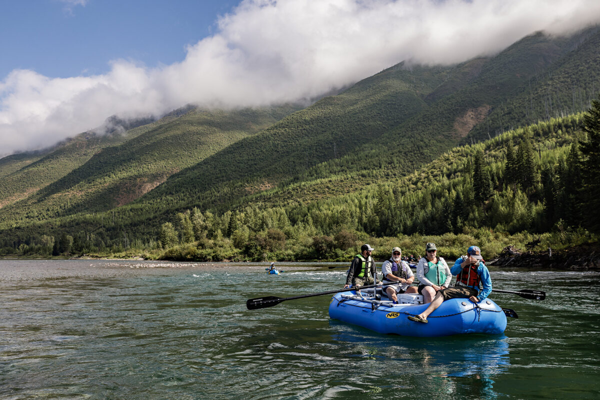
While the Middle Fork sees the most commercial use out of all three forks, little would change for outfitters who are currently permitted to guide on the river. In the proposed action, total outfitter and guide service days would be set at 86,000 service days on the sections spanning from Cascadilla Creek to Blankenship Bridge. The use limit is currently un-capped.
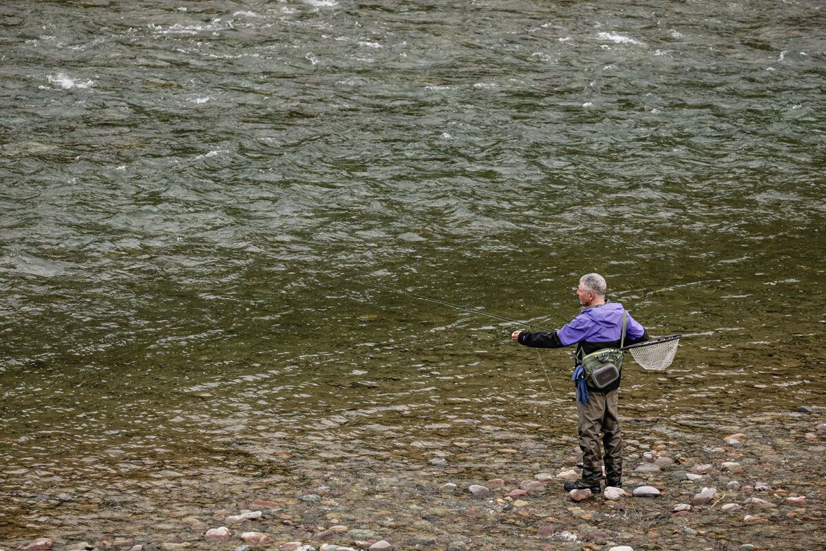
Lee Jester, a West Glacier resident who has owned a house on the river since 2005, said he has counted 1,000 boats during busy days in recent years, observational data he collected as a volunteer with the Flathead Rivers Alliance, a nonprofit conservation organization.
During the summer, Jester fishes nearly every day and, in addition to a surge in recreationists, said he’s noticed the river appears to be changing its course and the fish are shrinking in size and quantity.
Living on one of the busiest sections of river, he said the noise pollution has gotten out of hand with the sound of loud music constantly floating by.
“If they could just turn off the boomboxes, that would be huge,” Jester said. “Boom the boomboxes.”
To remove pressure from mountain goat populations on the Middle Fork, dogs would be prohibited between Bear Creek and Essex under the proposed action, and boaters would be required to continuously move downriver in the main current from below Staircase Rapid to Split Rock.
According to the document, the proposed user capacity for the Middle Fork from West Glacier to Blankenship Bridge is 1,280 people while a user capacity of only 30 people would be prescribed on the South Fork section from the confluence of Youngs and Danaher creeks to Mid Creek in the Bob Marshall Wilderness.
Management officials said the rise in use on the South Fork tracks with the rising popularity of packrafts, which allow for self-supported access into the Bob Marshall Wilderness. With the accessibility of these compact boats, a lack of river knowledge became an issue during the peak pandemic years, officials said.
“People who didn’t have much previous experience were going out and buying all the gear — and this happened particularly during Covid — and they were heading out in the backcountry and not having the Leave No Trace training,” Nate Bech, of the Spotted Bear Ranger District, said. “We had pretty significant waste, but we have seen tremendous improvement with education from rangers.”
Packraft usage has also seen a rise on the wild section of the Middle Fork in the Bob Marshall Wilderness, but Davies said the current proposed action plan doesn’t recommend significant changes on that river segment, which he attributes to its relatively short season, running from spring until early summer, as well as party size restrictions that are already in place.
The data used to determine the user capacity numbers was gathered through river patrols and other surveys from 2009 to 2023, but officials say more concrete data is needed for future planning.
“This is our best guess — it is very much a marriage of science and art trying to develop these user capacities,” Greenwood said.
To collect more accurate data, officials are proposing to implement a mandatory unlimited permit for each fork, which would also include educational information about river safety and etiquette for users.
“There’s no cap to it, and what we’re trying to do is get a better sense of how many people are actually using the river,” Greenwood said. “You’re trying to take those informational numbers and come up with existing use — which is really hard because they all have holes in the data. Getting those permits allows us to monitor the amount of use that’s actually going on and then also help us validate these estimates around capacity.”
The details of the potential permit rollout have not yet been outlined, but officials encouraged the public to submit feedback during the public comment period.
Davies echoed Greenwood and said data collection is a key component of the proposed action and the pandemic-triggered spike in recreation caused the agency to reevaluate capacity.
“It really caused us to just pause and really think about how to come up with capacity,” Davies said. “I think this has a really solid monitoring plan so we can measure people and impacts and detect that trigger point where we start to see some management actions.”
Davies said some members of the public have grown concerned about the potential of a lottery permit system on the three forks, which is not mentioned in the proposed action, and he described that type of management as a last resort.
If a lottery system was implemented, Davies said it would be many years into the future and it would be dependent on the Flathead Valley’s growth and recreation use. The wild section of the South Fork in the Bob Marshall Wilderness would likely be the first river to require such restrictions due to the angler pressure on the declining bull trout population.
Biologists with Montana Fish, Wildlife and Parks (FWP) have long been advocating for angler survey implementation to help fill in missing gaps related to fishing pressure, a component that FWP Region 1 fish biologist Leo Rosenthal said is essential.
“We’ve seen increases in all three forks and with the amount of population increase and tourism — there’s just more and more use,” Rosenthal said. “Everybody’s interested in an angler survey and knowing how much angling is actually going on and how many fish are being caught and released.”
Flathead Rivers Alliance Executive Director Sheena Pate said monitoring indicators is another missing piece of the proposed action, but she’s hopeful it will be part of the CRMP draft. For example, indicators that hit certain thresholds like occupancy at put-ins and take-outs, campsite occupancy, and impacts to wildlife crossings should have clearer management directives.
Pate also hopes the nonprofit organization can be a partner in the monitoring process.
“In the proposed action plan, we would like to see those and an expanded list of key monitoring indicators for visitor use experience while having a more robust menu of proposed actions,” Pate said. “We look forward to the agencies continuing to provide a collaborative planning process for a river system worth protecting for future generations.”