Columbia Falls Finalizing Future Land Use Map Ahead of Public Hearing
The city council got its second look at the map, which will help guide growth and development over the next 20 years, ahead of the first public hearing at the planning commission next week
By Lauren Frick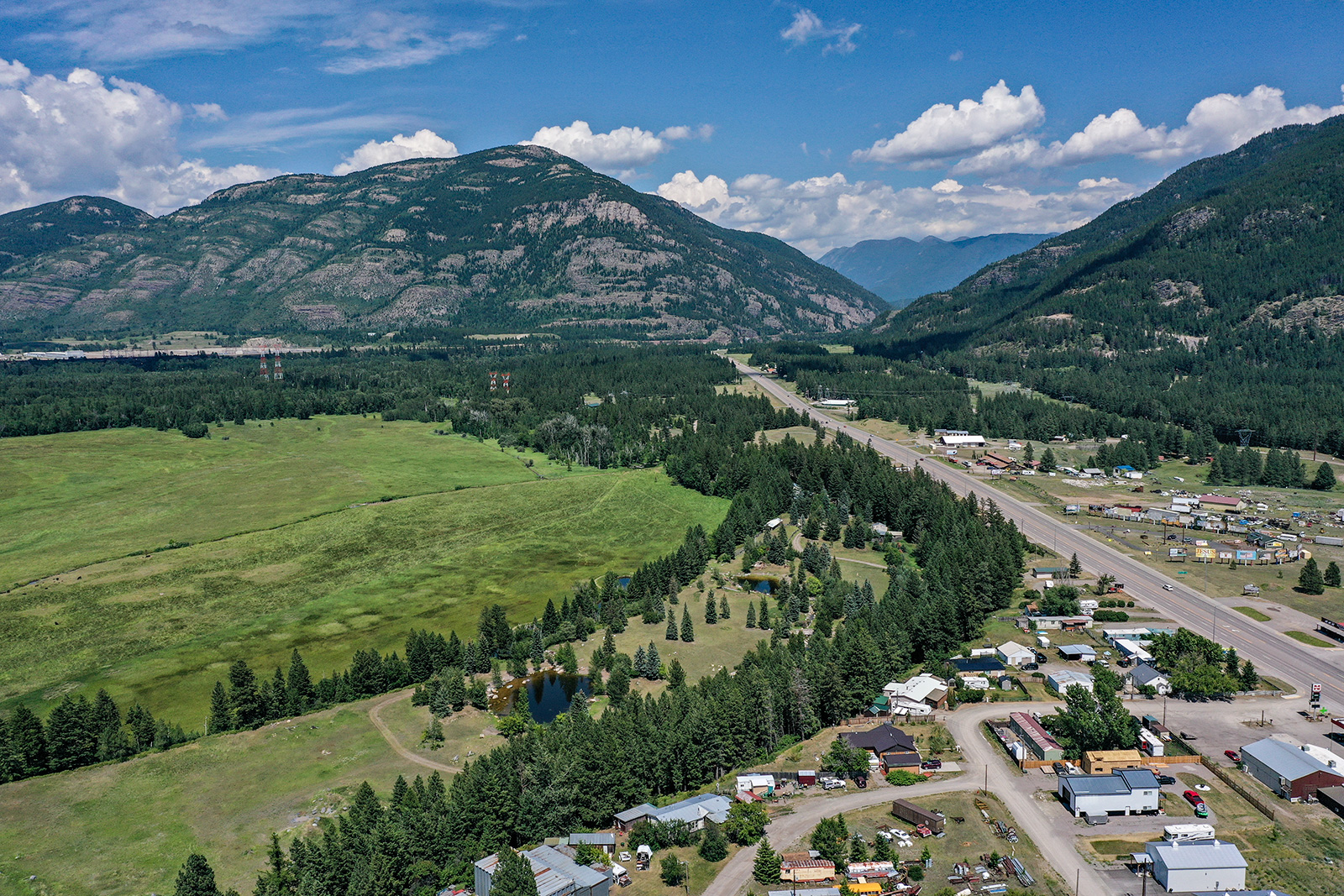
The Columbia Falls City Council on Monday night got its second look at the land use map that will help guide the city’s growth and development over the next two decades — another step closer to completing the state-mandated update to its 2019 growth policy.
With the land use plan draft now through both the city council and planning commission, the map, along with the entire future land use plan and updates to the city’s zoning and subdivision regulations, will all go before the planning commission for a public hearing on May 14.
Consulting firm Cushing Terrell, which has been responsible for piecing together the new land use plan, will send a completed copy of the plan to the city that will be posted for public comment later this week, City Manager Eric Hanks told councilors Monday. Community members will have the opportunity to view and leave public comment on the plan and land use map through the city council’s final public hearing on the matter in mid-June.
The future land use map serves as a foundational piece in the city’s update of its 2019 growth policy and land use map to meet new state requirements.
In May 2023, the Montana Legislature adopted Senate Bill 382, which created the Montana Land Use Planning Act (MLUPA). Under the statute, 10 cities across the state, including Columbia Falls, Whitefish and Kalispell, are required to adopt a new land use plan and update local zoning and subdivision regulations in accordance with MLUPA to accommodate for the city’s projected population growth.
In Cushing Terrell’s analysis of the city’s current land use map, in addition to surveying hundreds of community members, the firm in the updated map proposed a series of changes from the 2019 version. Several of those changes pertain to adding new land use designations, such as “downtown” and “innovation/flex.”
The land designations throughout the land use map help define the intent, uses and character the city would like to see in an area. The designations aren’t regulatory like a zoning ordinance, but instead can help inform any updates or changes to the city’s zoning code.
“If a property were to come to the council to rezone, you would look at this map and see if it’s compatible for the most part, and then that’s when that decision is made; the zoning limits, the building height and setbacks and things like that,” Nora Bland, Cushing Terrell’s planning director, told councilors at their April 20 meeting. “We are just kind of providing an image or a vision of what it could be in the future.”
Cushing Terrell also highlighted what it deemed as “opportunity areas” for the city, which the firm identified as Highway 2 and Halfmoon Road, Cedar Palace and the potential housing project on land formerly owned by the Columbia Falls Aluminum Company, Teakettle Heights.
“The opportunity areas are priority areas for growth,” Bland said. “They’ve been carefully evaluated for the highest and best use of the property, their role in the greater land use and economic fabric of the city and based on what we’ve heard through community input.”
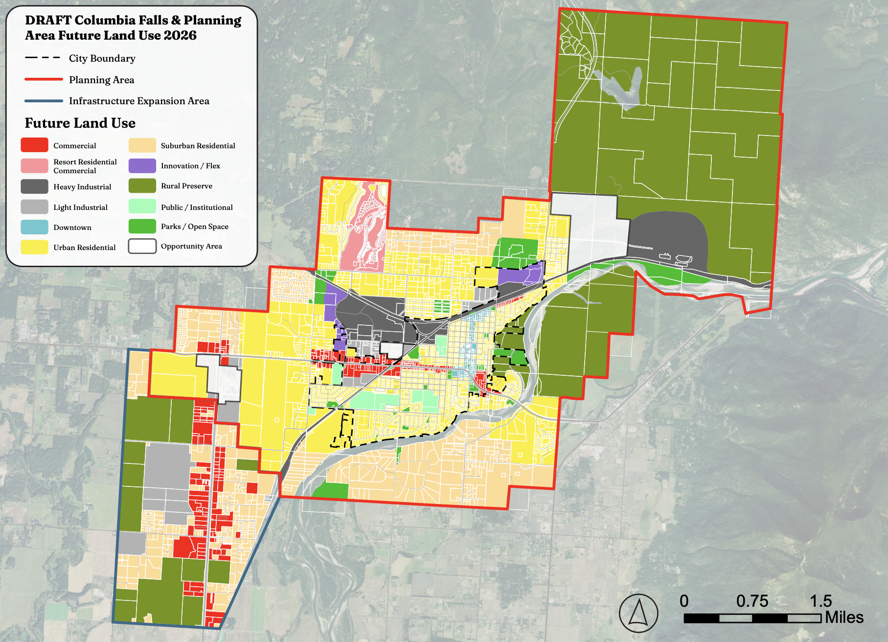
Adding an “infrastructure expansion area” was another key change to the 2019 map proposed by Cushing Terrell.
Infrastructure — particularly the city’s water and wastewater treatment systems — has been a key topic as the city has progressed through its engineering reports for MLUPA. Through separate studies of the respective systems, local engineering firms so far have come to similar conclusions: the city will need to undertake a series of improvement projects across each system in order to effectively keep up with projected population growth — and in the case of water, to bring the current system into full compliance with Department of Environmental Quality (DEQ) criteria.
Cushing Terrell also highlighted infrastructure concerns in its land use map presentation to city councilors, noting areas of high septic risk across the city.
“We’ve heard how important the Flathead River was to the community and the natural resources,” Hanks said at the April 20 meeting. “We have several areas that have extremely high septic risk due to the age of systems, unpermitted systems, and vicinity to surface water as well as high ground water.”
To address some of these infrastructure concerns as the city grows over the next 20 years, the firm implemented the proposed infrastructure expansion area into the land use map, even adding a series of land use designations throughout the boundary to help guide the type of growth.
“This is just north of the airport, along Highway 2, the commercial corridor,” Hanks said, referencing the infrastructure expansion area. “That’s a very underutilized commercial area and light industrial area. The businesses there have had challenges expanding and growing due to the septic risk and adding more septic systems or larger septic systems.”